


Another cold day, warming temperatures this weekend
INDIANAPOLIS (WISH) — Temperatures will remain about 20° below average today.
This morning:
An area of low pressure continues to hover over Indiana, creating cloudy skies, chilly temperatures, and some gusty winds along with scattered flurries this morning.


Thursday:
The slow-moving low will continue to create chances for light precipitation in the morning and scattered chilly rain showers heading into the afternoon. At times, we could have snow mixing in with the rain, just like we did on Wednesday.


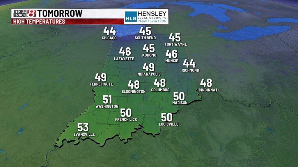
High temperatures only top out into the upper 30s and lower 40s this afternoon.


Thursday night:
We should be relatively quiet tonight, with cloudy skies and lighter winds. There could be a few flurries flying around through the overnight hours too. Overnight lows dipped down to the mid and upper 30s.

Friday:
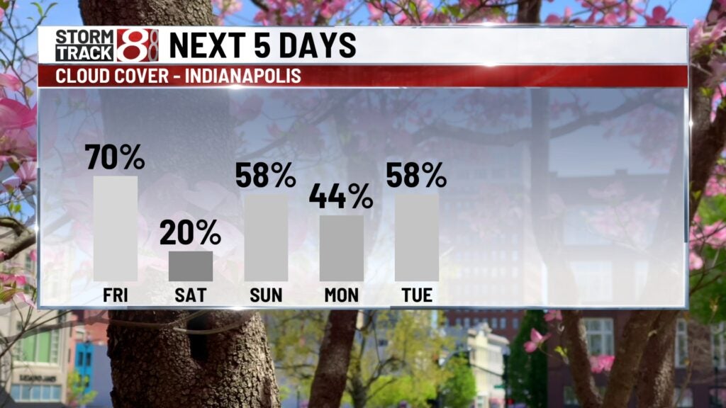
Friday will be another cloudy day with a few flurries in the morning. We’ll gradually break out some sunshine as we head later into the afternoon hours. Temperatures should rebound a bit, but they will still remain about 10° below average for this time of year.

Hard freeze possible:
With clearing skies Friday night, we’ll likely see temperatures dipping two near the freezing mark and, in some areas, likely below freezing. Frost will be likely across much of central Indiana heading into Saturday morning. We’ll likely have equally chilly temperatures Saturday night as well.

The weekend:
The weekend does look warmer, with a quiet start to the weekend on Saturday. Expect lots of sunshine with highs into the mid and upper 50s for Saturday afternoon.
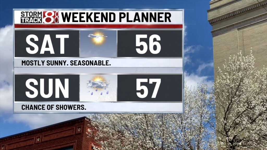
We’ll start Sunday off dry with partly cloudy skies, and we’ll finish with highs into the mid and upper 50s Sunday afternoon. There will be a boundary moving in late in the day Sunday into Sunday night that will likely bring some scattered showers and storms to the area.

Solar eclipse:
There are some signs that we might get lucky and be in between two systems as we head into eclipse day on Monday. Right now, we’re looking at partly cloudy skies as we head into your Monday afternoon. We do feel very confident that it will be a warm day as well, with highs returning into the lower 70s to start off the work week.
8 day forecast:
The pattern will ramp back up for the midweek. Still very mild, with highs into the upper 60s and lower 70s for Tuesday, Wednesday, and Thursday, but there will be several rain and thunderstorm opportunities through the middle of next week.
