


One more cold day before we track our next warmup and rain chance
INDIANAPOLIS (WISH) — Today was the classic definition of a miserable winterlike day thanks to snow, strong winds, and cold air. We’ll have to deal with one more rather cold day before we find ourselves climbing back up in the temperature department.
This will also lead way to additional rain chances into Christmas weekend.
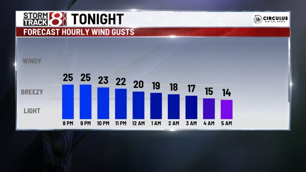
Monday night: Much of central Indiana will be done with snow by roughly 8-9 PM. However, locations in northeastern Indiana will still see some lingering snow shower activity going into the overnight hours.
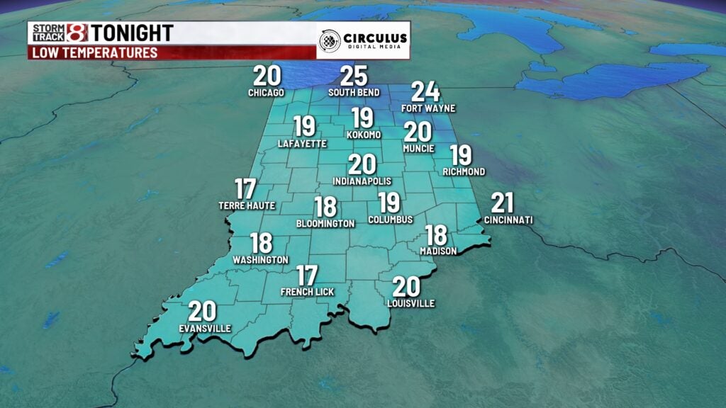
Lows will tumble into the upper teens to low 20s, but it is even more important to mention that it will feel more like the single digits to low teens due to the breezy winds.

Tuesday: We’ll begin to make some improvements in this forecast starting Tuesday. Sunshine and lighter winds will return to our area, but air temperature wise, it will still be cold. Highs will only get into the mid 30s after starting our Tuesday in the upper teens/low 20s.


Wednesday: Warmer air will greet our presence on Wednesday, and this will start our next gradual warming trend as a whole. Skies will turn partly cloudy as highs return to the mid 40s. Winds will also remain light out of the south.

8-Day Forecast: The warmup continues through the end of the workweek and Christmas weekend. We will also watch for a series of rain chances that look to start getting back into the mix as early as Friday. A few showers could linger into Saturday. By Christmas Eve and Christmas Day, we may be talking temperatures in the mid 50s. A second system may give us more rain chances Christmas Day into next Tuesday. Stay tuned to the latest on your holiday weekend forecast.
