Tracking some rain Friday; brisk weekend to follow
INDIANAPOLIS (WISH) — We hope you got to enjoy today’s warmth as much as possible because we will embark on a fast track towards much colder air this weekend. Rain chances are also set to pop-up preceding the cold.
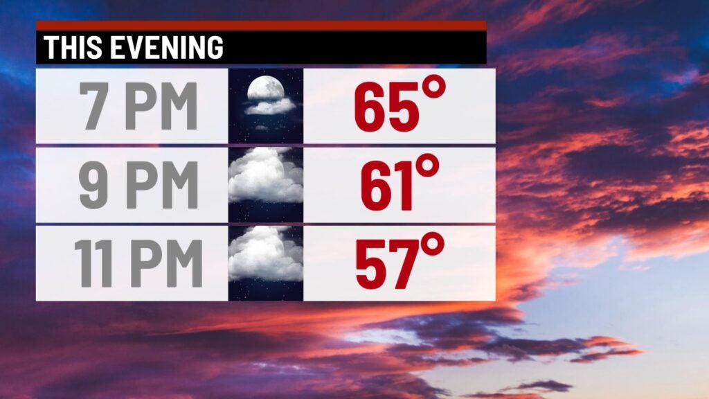
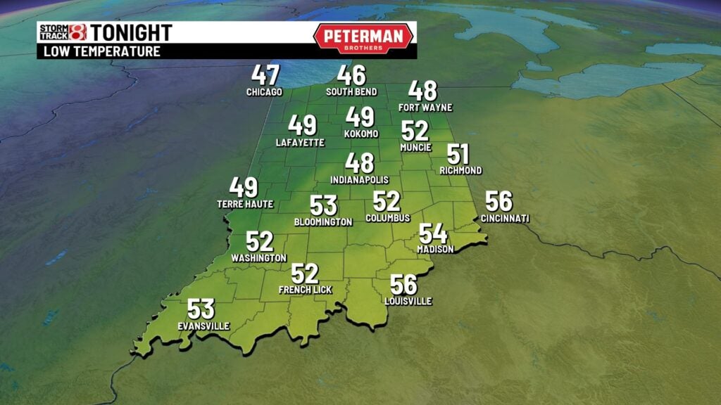
Thursday night: Another mild night with increasing cloud cover will be on deck. Lows will once again fall into the upper 40s.
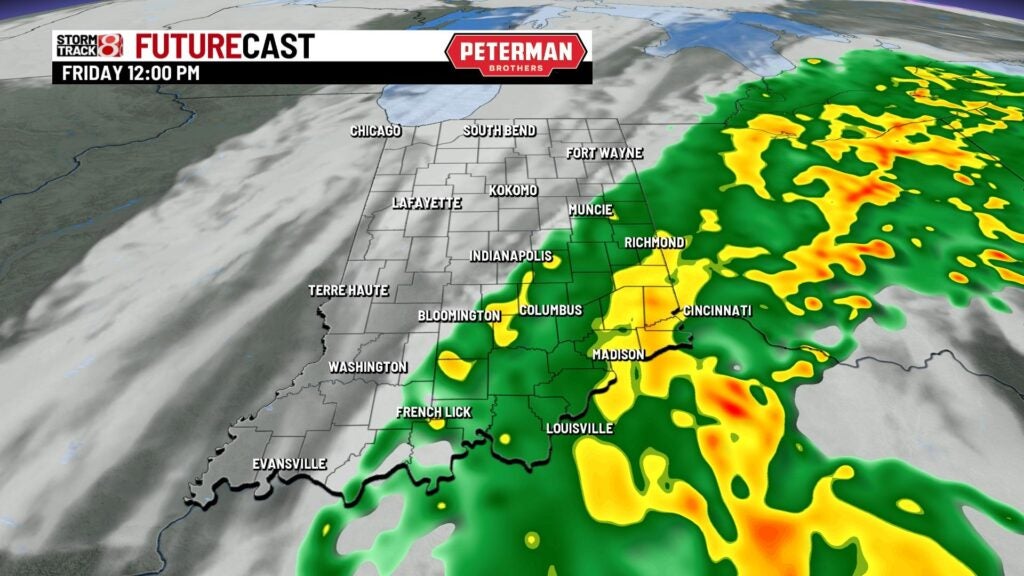
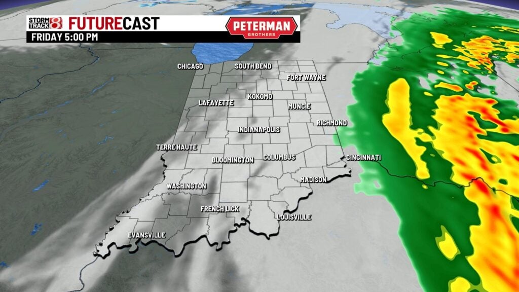
Friday: The pleasant weather we have been dealing with will unfortunately be going away. First, the remnants of Nicole will bring showers to portions of central and southeastern Indiana. Latest trends have shown that rain will scoot much closer to the Indy metro as well. Not everyone will see rain, but there will be extensive cloud cover. Activity will move out completely by dinnertime.
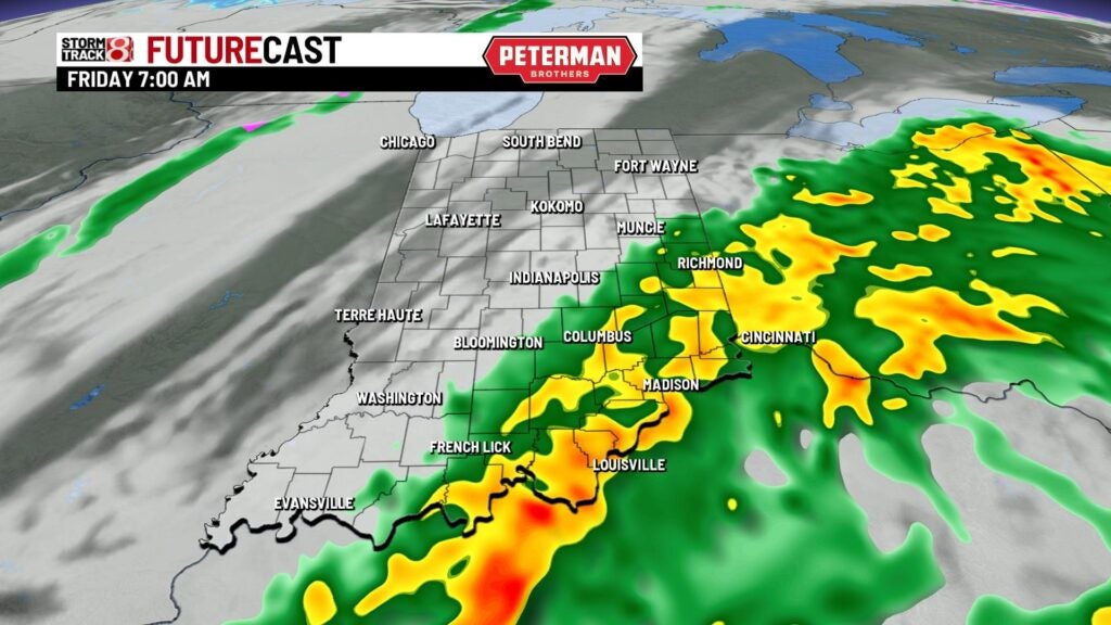
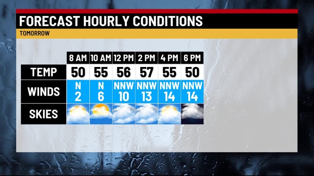
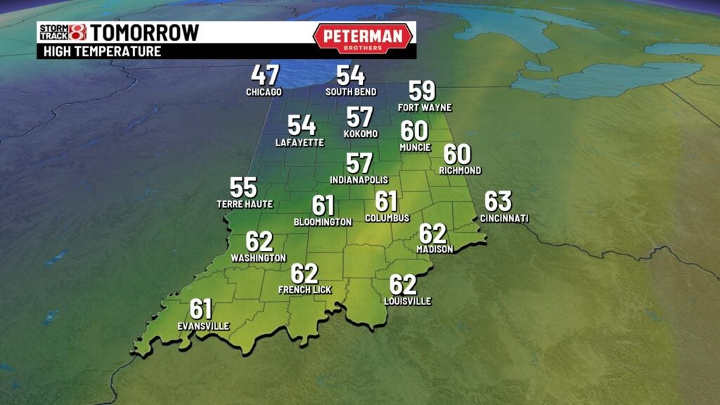
A front will also be sliding across the state during the day, which will usher in breezy winds out of the northwest with cooler air. Highs will struggle to get out of the 50s with wind gusts up to 25-30 MPH at times.
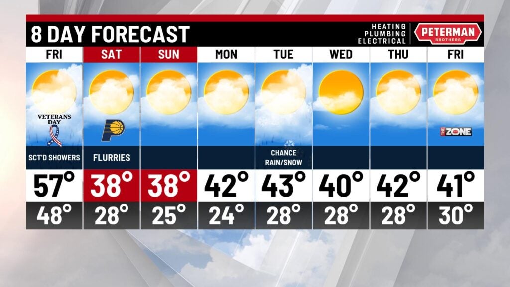
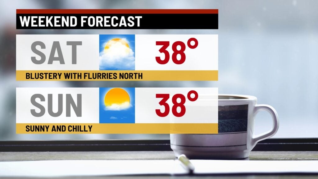
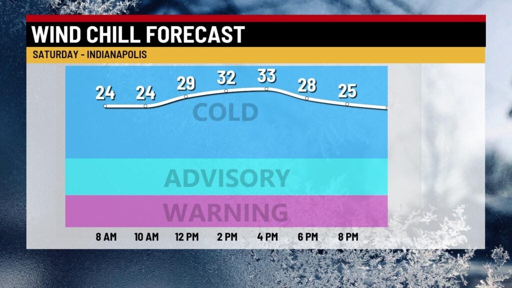
Weekend cold: You will need to get out the heavy winter coat as winterlike air settles in for Saturday and Sunday. Highs will have a difficult time making it into the 40s for some spots. On top of that, wind chill values are going to be in the 20s at times. Sunday morning could even feature wind chills in the teens for some of us. We also can’t rule out flurries north of Indy on Saturday.
8-Day Forecast: There is more bad news with this forecast, and that is this cold air will stay locked in throughout next week. We’ll work in the chance for a rain/snow mix next Tuesday. Expect daytime highs to only top out in the low 40s.