


Strong storms possible Monday evening
INDIANAPOLIS (WISH) — Active pattern will bring heavy rain to the area, along with a few strong storms.
This morning:
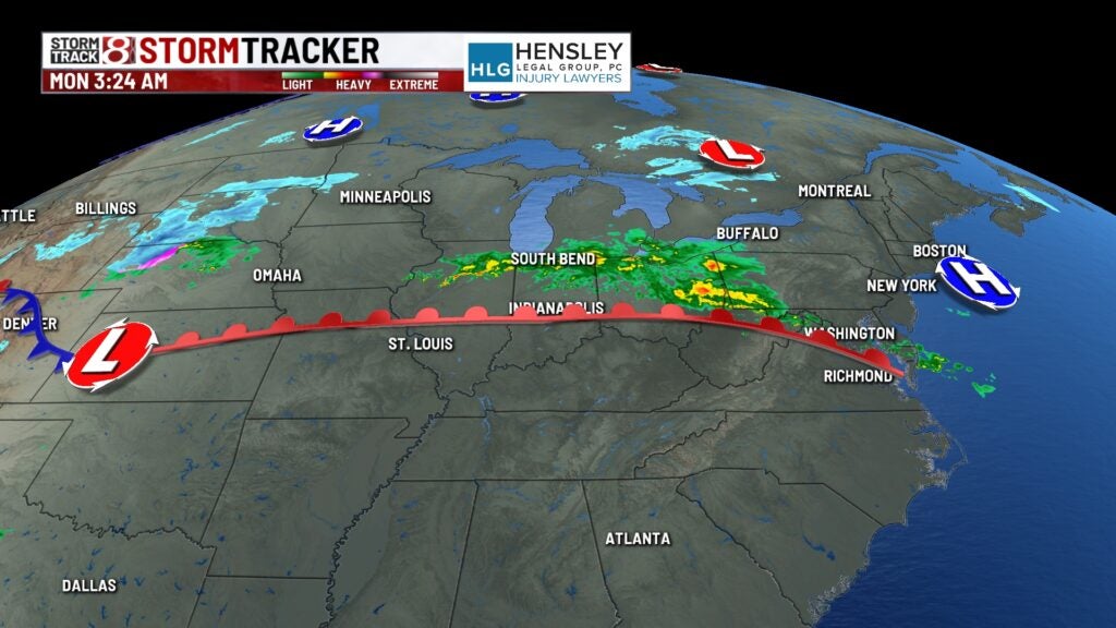
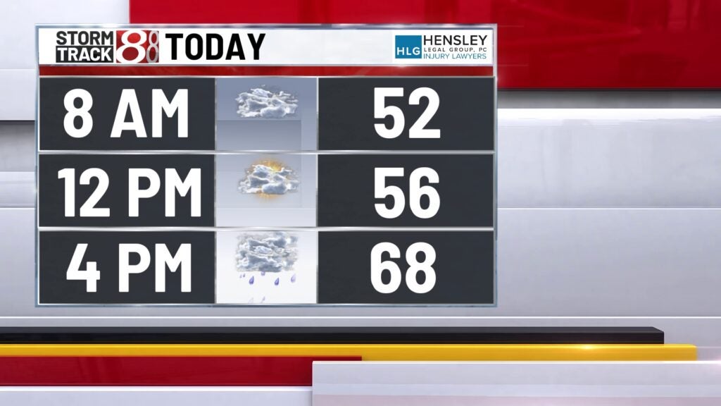
As we kick off the morning, we’re left with a lot of cloud cover and some showers, mainly in the northern portions of the state. Any rain opportunities we have for the first half of the day should be very isolated and very light.


Monday:
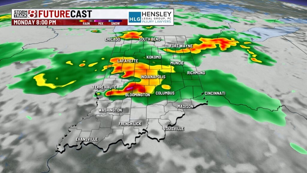
The atmosphere will become much more unstable as we get later on into the afternoon. We expect thunderstorms to develop by mid-afternoon in Illinois, and those storms will likely move into central Indiana by late afternoon at the earliest, but more than likely into the early to mid-afternoon hours tonight.
Monday night:
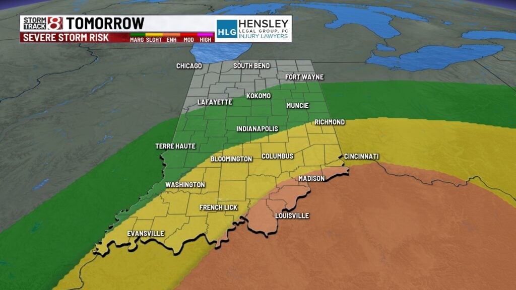
Storms that develop later this afternoon into the evening have the potential to become severe. The main threat will be damaging winds and large hail, but there is an isolated tornado threat as well.
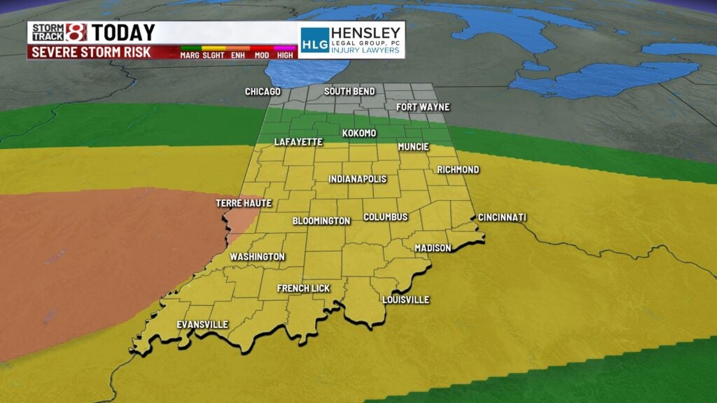
Meanwhile, heavy rain is expected for much of the evening and overnight hours tonight as the severe weather threat starts to wane heading into the overnight hours. Many areas could pick up anywhere from one to two inches of rainfall, with some locally higher amounts, which could lead to some localized flooding issues.

Tuesday:
A cold front will move through the state on Tuesday, which will also spark scattered showers and thunderstorms throughout the day. There will be another round of strong thunderstorms possible, mainly in the southern and southeastern portions of the state, on Tuesday afternoon. The main threat will be damaging straight-line winds and large hail.


Wednesday:
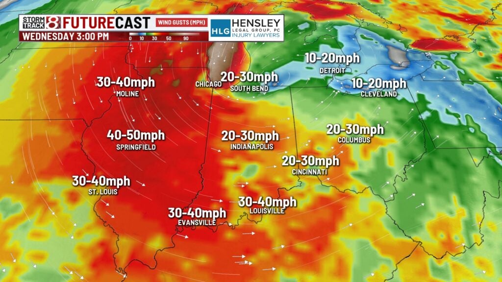
Much colder temperatures are sliding in as we head into Wednesday. We will likely be cold enough that we will see a transition from rain to maybe a rain-snow mix for parts of the day on Wednesday. We also expect gusty winds of up to 40 to 45 mph, making it feel even colder throughout the day on Wednesday.


8 day forecast:
We should quiet things down for the end of the week and watch for near-freezing temperatures on Thursday and Friday mornings, which will likely kill off any tender vegetation again. The weekend does look better, with high temperatures back to near 60 for Saturday and into the low to mid-60s for Sunday. We are a week away from the solar eclipse next Monday. Right now, it does appear there might be a chance of showers, but temperatures do look to be very warm, with highs near 70.
