Revisiting the record-breaking Labor Day 2003 flooding in Indiana
INDIANAPOLIS (WISH) – Central Indiana was gripped with major flooding to start September of 2003. The amount of rain that ended up falling would lead to record-breaking stats that still stand to this day.
The weeks leading up to the Labor Day 2003 flood were not all that quiet at times. In fact, there was even a bad flood that took place two months prior to Labor Day in early July. Between eight to 13+ inches of rain fell in north central Indiana, which in turn flooded Deer and Wildcat creeks. The early July and Labor Day 2003 flood stats will be compared further towards the end of this story.
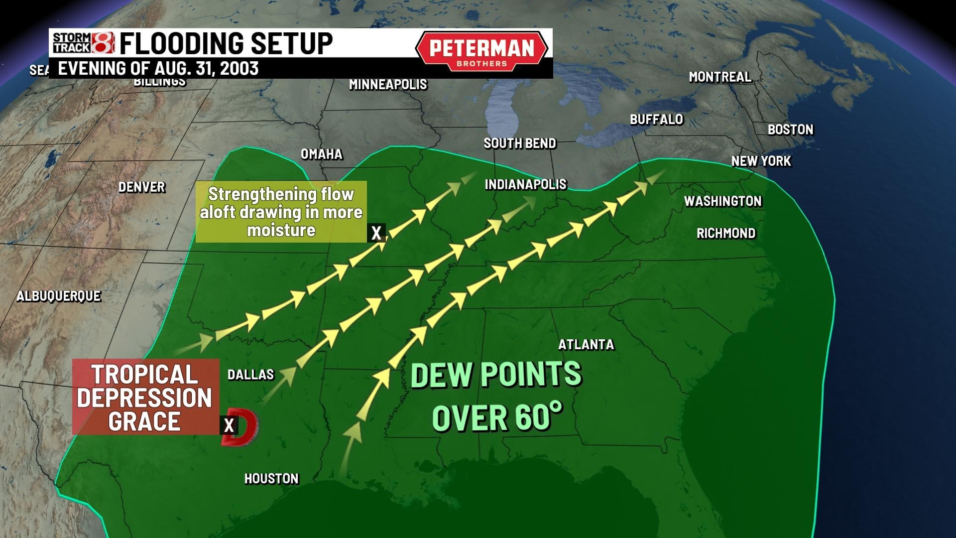
Fast forward to August 31, 2003, central Indiana was set to work in a little bit of rain that day due to an incoming system. The Indianapolis International Airport would pick up 1.06” of rain on Aug. 31, but this was nothing compared to what was about to come. A low pressure system was sliding into Indiana along a front going into the start of September. At the same time, tropical depression Grace was ongoing in Texas. Grace would aid in high levels of moisture being transported into Indiana as winds aloft strengthened to help drive that moisture into our area.

The combination of the moisture and nearby low would give way to extended heavy rainfall. Central Indiana would be in for a rude-awakening on the morning of Monday, Sept. 1 as flooding was already occurring during the pre-dawn hours. The weather service in Indianapolis would issue a flash flood warning shortly after 6 AM EST for Putnam, Hendricks, and Marion counties. This was due to two to three inches of rain having already fallen in the warned area for the past three hours. At 7:31 AM EST, the warning was updated to mention that most areas have now received four inches of rain, and areas near Pittsboro in Hendricks had already gotten five and a half. Recent rain from Aug. 31 along with the ongoing activity was causing conditions to quickly deteriorate with rising rivers/creeks, and flooding neighborhoods.
An additional 0.03″ of rain fell on Sept. 2 in Indianapolis while areas north of Indy got in on an additional 2+ inches. In the end, the Indianapolis International Airport would pick up a staggering 7.20″ of rain on Sept. 1, which is still Indy’s wettest single calendar day on record. This broke Indy’s old wettest day record of 6.8″ from 1895. The white river in the southern part of Marion county would rise 15 feet in only 18 hours, and this was the greatest flood in this area since New Year’s Day 1991. Muncie and Anderson also had considerable flooding as the white river in those areas crested to its highest levels since both April 1964 and June 1958. Hamilton county also had very significant flooding problems as over eight inches of rain fell in parts of the county in a three day span.


Widespread issues would end up developing because of the dangerous flooding. Schools would have to close, numerous evacuations took place from homes and vehicles, and the National Guard was called in to assist road closures and rescues. A local newspaper account noted that nearly 3,000 people had to apply for food assistance in central Indiana. Flood damage cost was also estimated in excess of $20 million.
There are a couple of interesting comparison points to be made between the July and Labor Day 2003 events. Despite Hamilton county’s lofty rain totals, the white river in this region had height levels that were roughly two feet below the July 2003 flood. On the other hand, with Greene county for instance, the resultant flooding would exceed the July 2003 event by two and a half feet.
