


Stubborn nearby system to leave and lead way to warming up by this weekend
INDIANAPOLIS (WISH) — Another damp and well below normal day transpired across central Indiana for our Thursday due to the very slowing moving system north of us. We will finally make better progress getting that system out of our area going into the weekend.
Once we do that, we will get our temperature comeback going.
Thursday night: As far as tonight goes, expect another damp one with scattered showers and mixed precip.


Lows will not tumble as much due to cloud cover being locked into place. We’ll only dip into the mid to upper 30s.


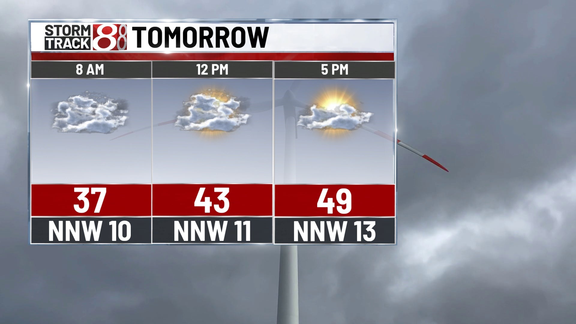
Friday: We will finally try to warm up a little bit to end the workweek, but lots of cloud cover will remain in place with more scattered shower potential during the daytime hours.


Highs are set to get into the upper 40s.


By Friday night, skies will quickly turn mostly clear. However, this opens the door for the possibility of a hard freeze due to even colder nighttime temperatures. This is why a freeze watch will be in place early Saturday morning. At the very least, frost is expected to develop with lows in the upper 20s to low 30s.


Saturday: After going through a frosty and cold start to Saturday, we’ll get to enjoy a mostly sunny and warmer day. Highs look to top out in the mid 50s.

8-Day Forecast: A dry Saturday will lead way to increasing rain chances for Sunday as scattered showers and even an isolated thunderstorm is possible. Highs will not get above the mid 50s Sunday due to the rain chance and increased cloud cover. In regards to the eclipse on Monday, it is trending partly sunny by the time the eclipse reaches 100% totality just after 3 PM EDT. We’ll also launch to around 70 by Monday as well. More in the way of rain may arrive through the middle of next week with high temperatures staying above 60 degrees.
