Remnants of Hurricane Beryl roll into Hoosier state; tornado watch issued for southern Indiana
INDIANAPOLIS (WISH) — The remnants of what was once Hurricane Beryl have arrived in Indiana, bringing drenching rain and the possibility of severe storms.
Interactive radar | Weather blog | Watches and warnings | Storm Track 8 weather app | Wind gusts
5:02 p.m.
Another storm now being given a Tornado Warning until 5:30 p.m. for parts of Vanderburgh, Warrick, and Gibson counties.

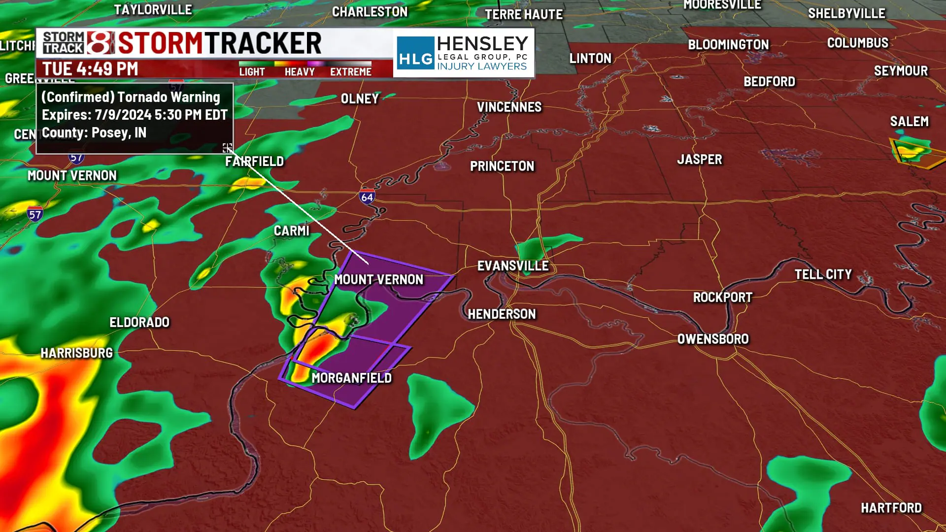
4:49 p.m.
First tornado warning of the day in Indiana is in far southern Indiana. Still got a few hours before these storms get into our core viewing area in central Indiana.
Weather service down there is calling this a tornado that could produce considerable damage.

4:35 p.m.
4:27 p.m.
3:32 p.m.
A tornado watch has been issued for southern Indiana, areas south of the Bloomington/Columbus line will remain under the watch until midnight.

2:04 p.m.
1:50 p.m.
1 p.m.
How common is it to have a tropical system or the remnants of one move across central Indiana? Storm Track 8 meteorologist takes a look at the record books.
11:28 a.m.
The National Weather Service Northern Indiana Office says a flood watch will be in effect from 5 p.m. CDT on Tuesday through Wednesday afternoon due to the risk of flooding caused by excessive rainfall.
Areas under a flood watch include the following counties: Eastern St. Joseph, Elkhart, Fulton, LaGrange, Marshall, Northern Kosciusko, Northern La Porte, Pulaski, Southern Kosciusko, Southern La Porte, Starke, Western St. Joseph, and White.
Excessive runoff may result in flooding of rivers, creeks, streams, and other low-lying and flood-prone locations. Flooding may occur in poor drainage and urban areas.