Warmer Thursday; cold front brings rain & a cooler weekend
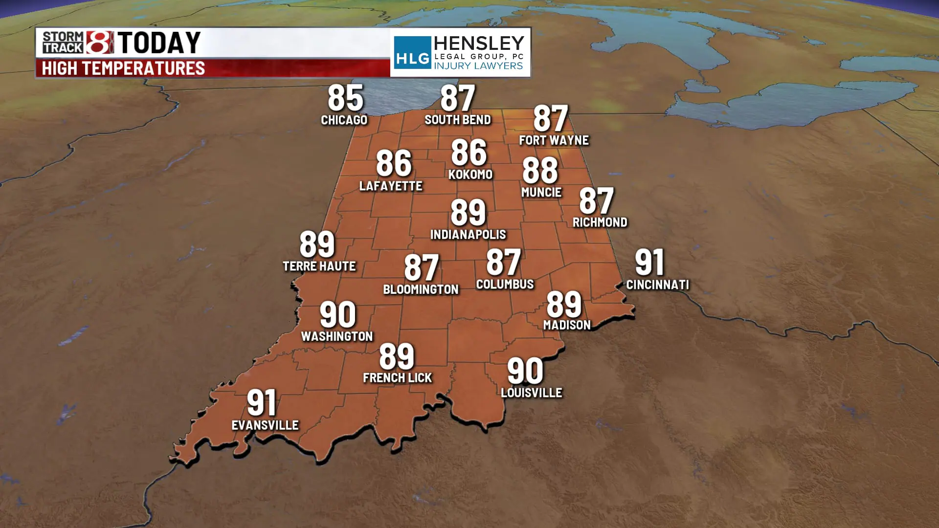
INDIANAPOLIS (WISH) — Temperatures could push close to 90° this afternoon.
This morning:
Temperatures are running much warmer this morning, with most of the area into the mid-60s. The Indianapolis metro area is still holding on into the 70s.


Thursday:
We’ll crank up the heat at least briefly as we head into the afternoon hours. Expect mostly sunny to partly cloudy skies with slightly higher humidity levels. High should top out close to 90° this afternoon. Feels like temperatures will be into the lower 90s.


Thursday night:
Quiet weather continues tonight under partly cloudy skies. Will stay warm and a bit muggy overnight with lows into the mid-60s.

Friday:
A cold front will pass through the state as we head through the daytime hours. This will trigger a narrow axis of rain along that front. Showers looked to be fairly light with little to no instability, meaning thunderstorms are very unlikely.


If there are any storms, they will likely be confined to the southeastern portions of the state, where there is a chance for maybe some gusty storms late into the afternoon and evening hours.

With the frontal passage happening around midday, expect high temperatures to happen much earlier in the day as we top out around 80° but fall into the mid 70s by later in the afternoon.

This weekend:
Much cooler temperatures for the weekend in the wake of Friday’s cold front. There could be a few isolated showers in the northern parts of the state very early Saturday morning, but most areas should be dry. It could be a bit blustery for Saturday morning with the cooler temperatures and breezy conditions with wind gusts up to 25 mph. Temperatures will struggle to get out of the 60s Saturday afternoon.

Pretty chilly temperatures Saturday night into Sunday as the entire state will slip into the 40s. Some parts of the state in northern Indiana specifically could see numbers flirting with the upper 30s for Sunday morning.

Despite the chilly start Sunday morning, we should rebound nicely with sunshine and very dry air. High temperatures will top out into the lower 70s by Sunday afternoon.

Extended forecast:
Quiet weather continues with a warming trend next week. Numbers return to the upper 70s for Monday, and we heat up back to the middle 80s for Tuesday and Wednesday of next week.

Dry stretch continues:
Rain opportunities look extremely limited over the long term. Not much in terms of rain over the next 7 days, and the 8- to 14-day outlook does show strong signals of below-average precipitation, and that would take us into the middle of September.

