Much colder Thursday; snow and rain Friday
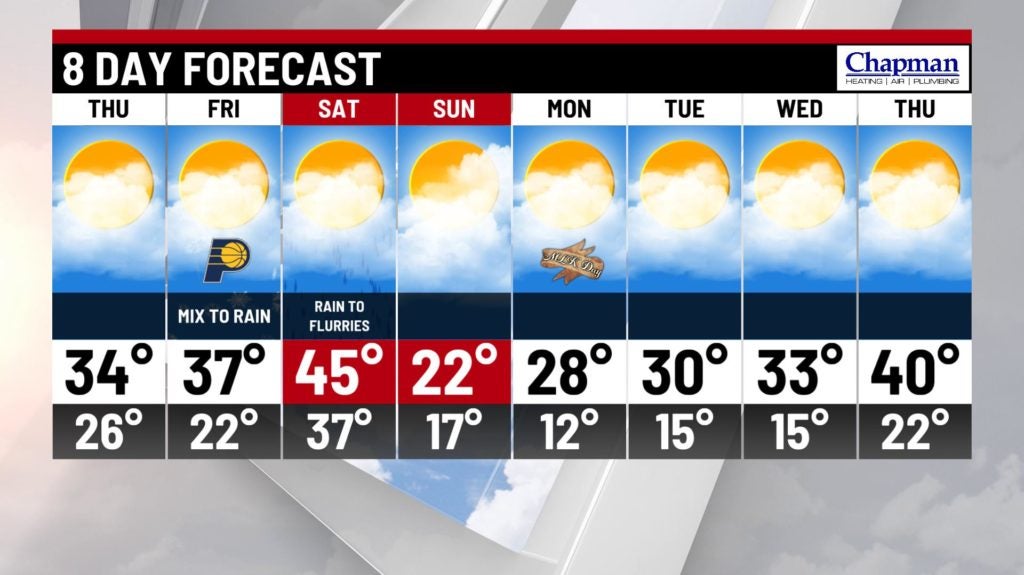
INDIANAPOLIS (WISH) — A brief reminder that it is indeed January in Indiana on Thursday, as highs struggle to hit the mid 30s. Much colder air moves in next week!
Tonight:
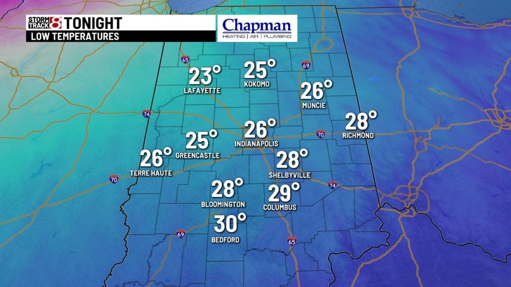
Any leftover fog and light shower activity should mix out as a cold front pushes through the state. Expect a mostly cloudy sky, with temperatures dipping to the lower to middle 20s.

Thursday:
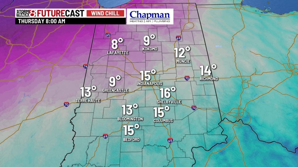
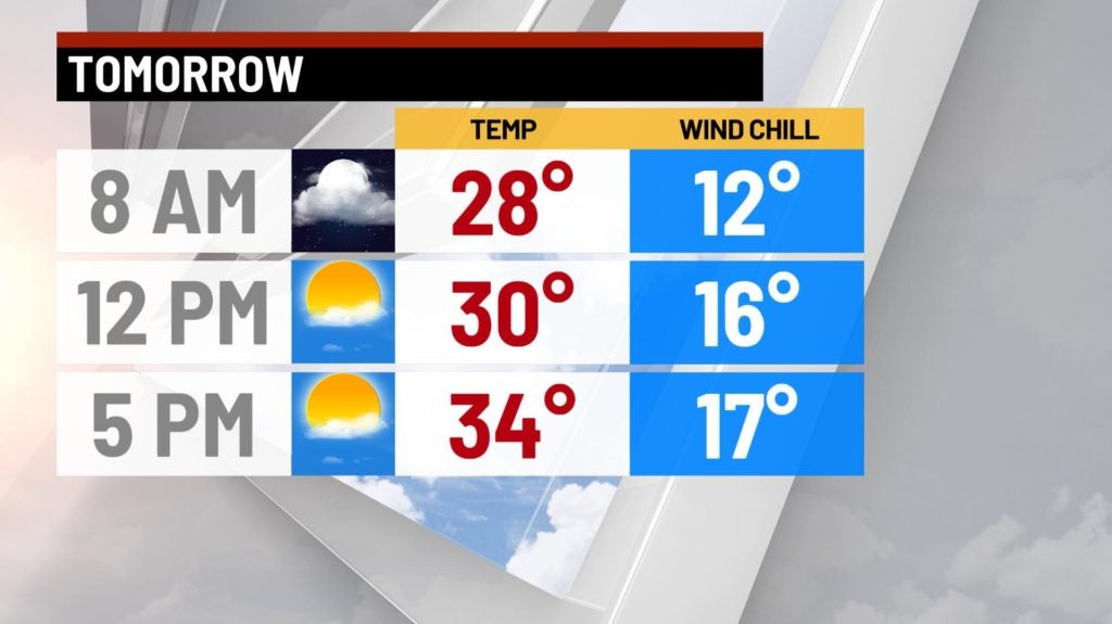
Clouds to kick off the morning, followed by partial clearing by the afternoon. Temperatures return to near normal levels for this time of year, with highs hitting the mid 30s.
Friday:
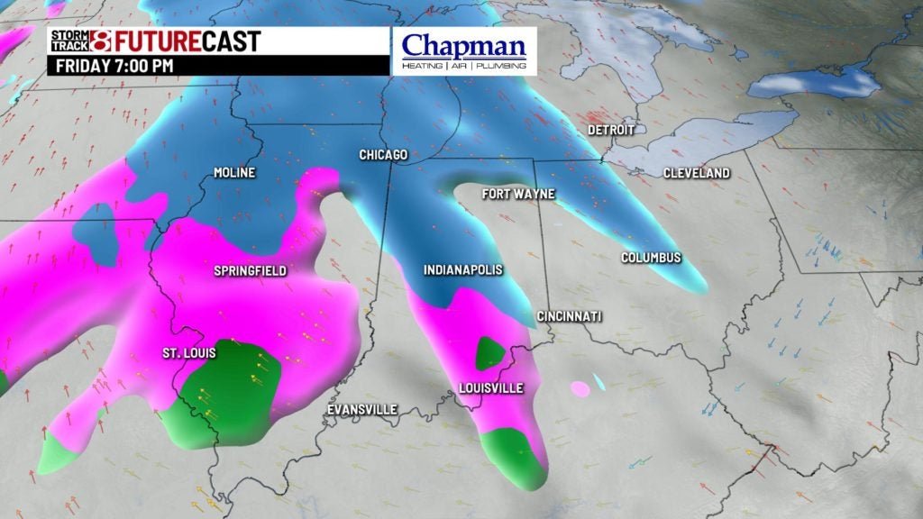
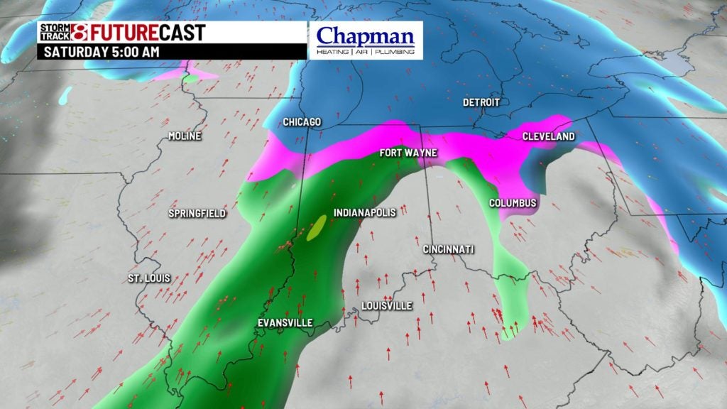
Next system of interest slides into the state Friday afternoon and evening. We’ll likely see this initially start as snow for the northern half of the state, with a wintry mix possible the the south. Eventually, as a warm front slides through to the north, temperatures will warm, and everything will transition to rain across the state.
Weekend forecast:
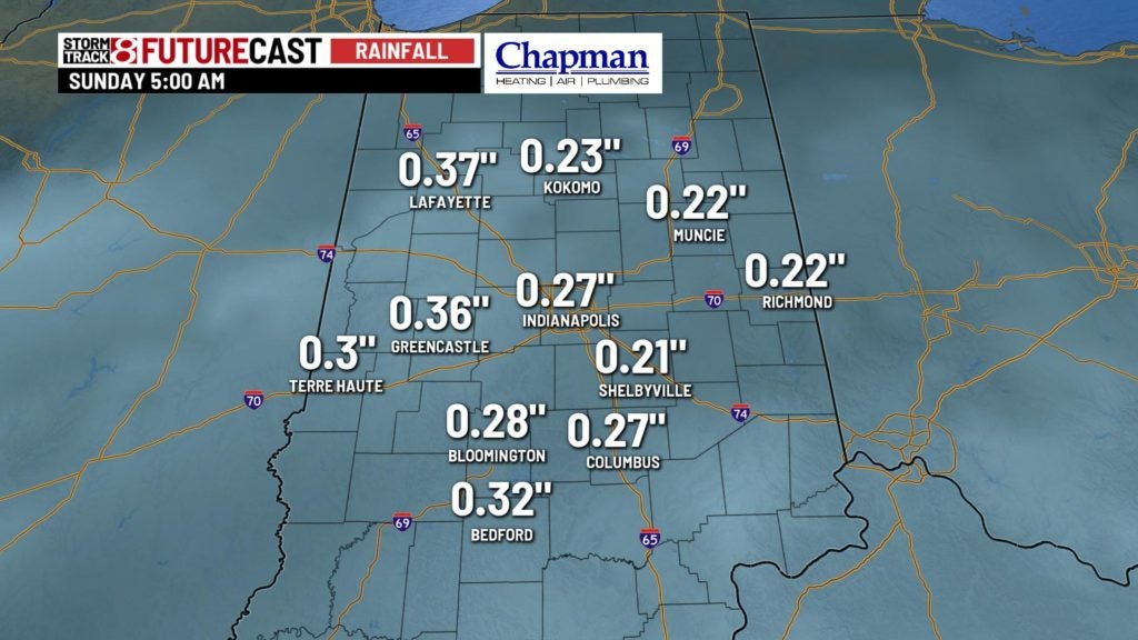
Wet weather hangs around for the first half of the day Saturday. Rainfall amounts could reach up to 1″ by Saturday afternoon, which will slow down the already slow moving improvement of flooding conditions on many area rivers.
Much colder air will follow heading into Sunday, but at least we will remain dry. Temperatures will struggle to hit freezing by Sunday afternoon.
8 day forecast:
Here comes winter in full force next week. Nothing major precipitation wise, but some pretty cold air, especially compared to where we have been, will fill in across the state starting Monday. Expect several days next week to see highs only in the 20s!
