
Active mid week
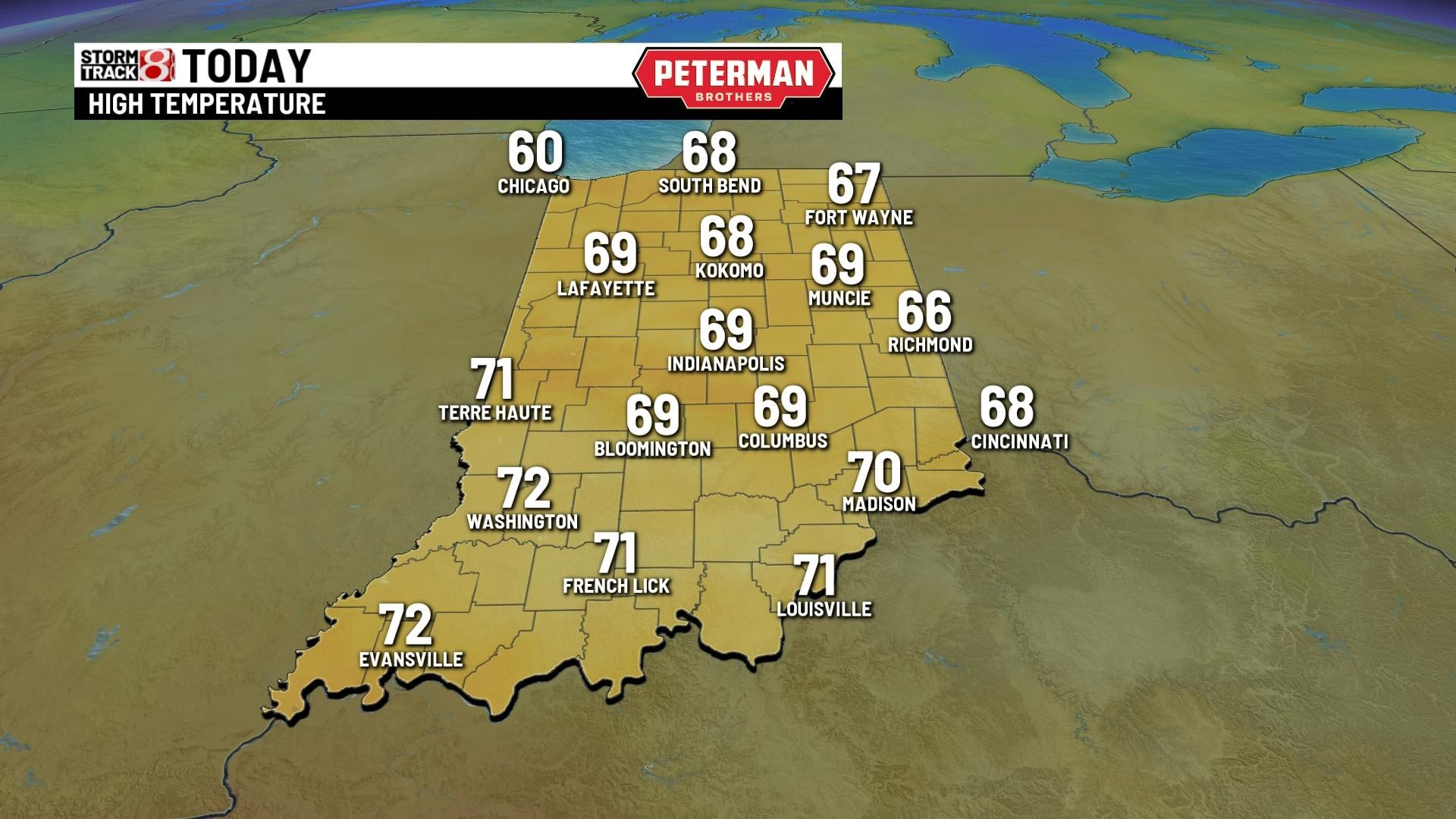
INDIANAPOLIS (WISH) — A foggy start to the morning for some with temperatures in the upper 40s to lower 50s. Today will be a mainly cloudy day with highs in the upper 60s to near 70°. We could see a spotty shower or storm pop during the afternoon with more dry time than not. Lows tonight will fall to the lower 60s.


Wednesday will be an active day with a high potential for severe weather. Most of the morning will be mainly dry with a scattered light shower. Those should move out late morning. There will be a break during early afternoon. Highs tomorrow will top out in the lower 70s. We’ll have strong storm possibly develop during mid to late afternoon with damaging winds and tornadoes as the main threat! A better chance of stronger storms arrive mid evening. Lows will then fall to the lower 40s.


Highs will cool through the remainder of the week! Highs will top out in the upper 50s Thursday and will remain near 60° by Friday with plenty of dry time and sunshine!Easter weekend right now looks cooler with highs in the lower to mid 50s with drytime. Next chance of showers arrives early next week with highs in the lower 50s.
