Hot, humid with several storm chances into the weekend
INDIANAPOLIS (WISH) — The active weather pattern continues today and into the end of the weekend. It’s going to be hot and humid with several rounds of showers and thunderstorms.
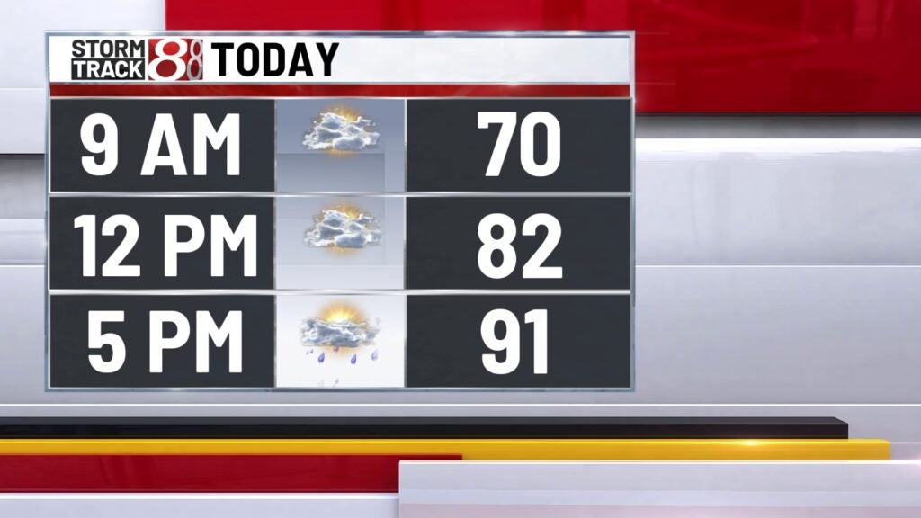
TODAY: Air quality has improved across the state! Winds have switched direction and storms have cleared out the atmosphere. Heat and humidity build throughout the day. Highs climb into the upper 80s and lower 90s. It feels more uncomfortable with high humidity. The heat and humidity fuel another round of showers and thunderstorms later this evening and during the overnight hours.


TONIGHT: A few spotty shower/storms this evening but a better chance for storms late tonight especially in southern Indiana. Some of the storms may be on the stronger side with heavy rainfall and gusty winds.


SATURDAY: Hot and humid again for the weekend. Look for partly cloudy skies Saturday with highs climbing into the upper 80s and lower 90s. It’s going to feel uncomfortable with high humidity. Storm chances are possible once again. Showers and storms are possible very early Saturday and another round which may produce more strong storms is likely late Saturday night. Some of the storms Saturday night may contain very strong winds similar to what we saw Thursday night. A slight risk of severe weather is expected.


SUNDAY: Same pattern continues for the end of the weekend. A ridge in the upper levels of the atmosphere brings several ways of energy right over Indiana. This track allows for rounds of thunderstorms, including strong storms right over the state. Stay weather aware throughout the weekend.


8DAY FORECAST: Temperatures stay into the middle 80s for the end of the weekend and into the first part of next week. Showers and storms are still possible Monday. Highs return to the upper 80s and lower 90s for the 4th of July.
