


Wet Saturday, hot and hazy Sunday
INDIANAPOLIS (WISH) — After a hot and muggy Friday, we will encounter a wet start to the weekend with warmer and muggy air keeping itself in place.
Friday night: Showers and storms will build in coverage going into the overnight hours. Expect heavier rainfall rates and rumbles of thunder with this cluster of activity.


The northern third of the state even has the potential to see isolated strong to severe storms tonight with wind and hail the main threats.

Lows are set to be on the warm side tonight with numbers in the upper 60s to low 70s. It will also be very humid.


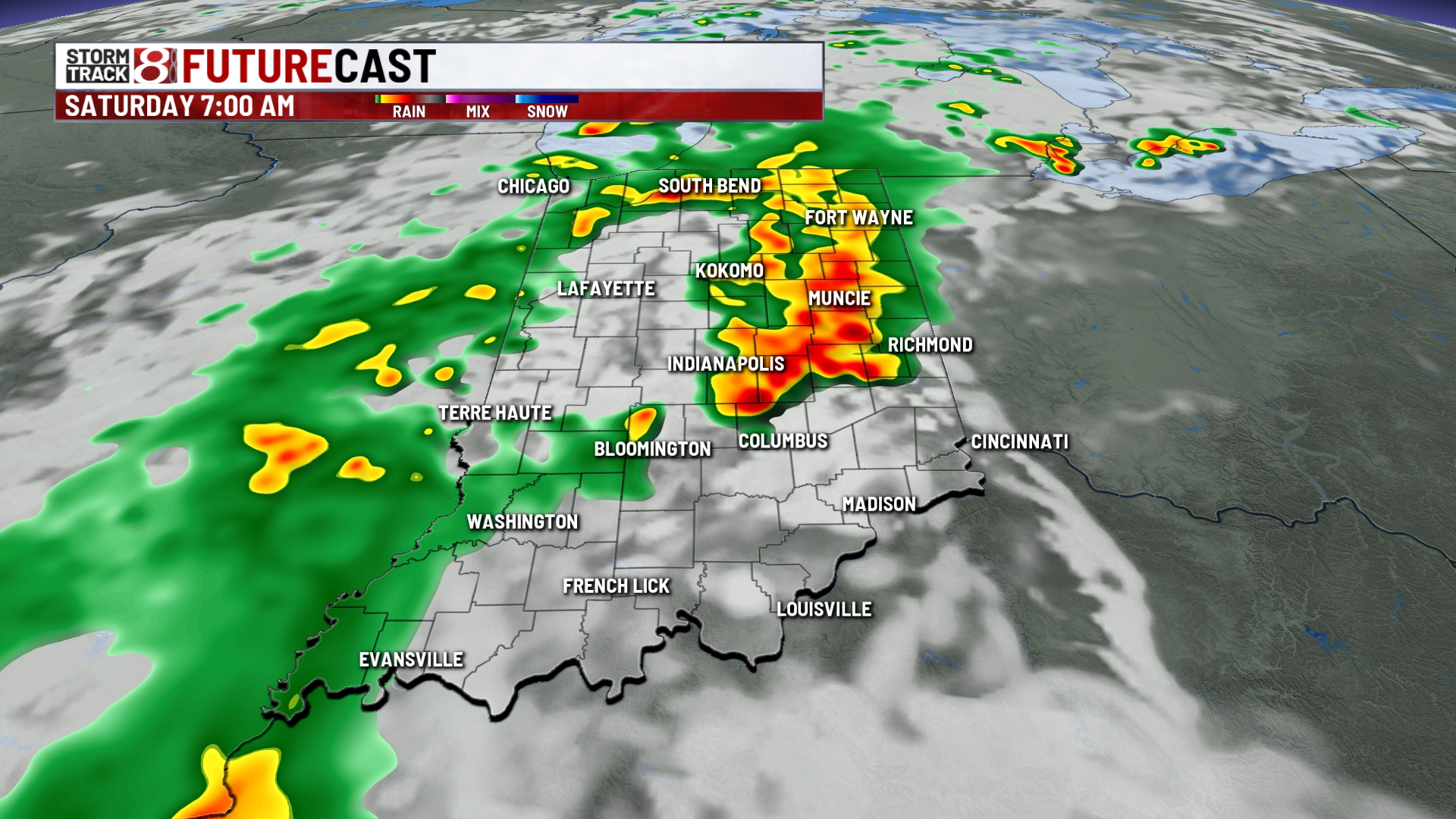
Saturday: We’re going to wake up to an active start to our Saturday. Expect showers and storms to persist towards the lunch hour before we work in a break. There could be scattered re-development of showers and storms Saturday afternoon and evening.


The severe risk for tomorrow has mostly moved itself into Ohio, but far eastern Indiana sits in a low threat for strong to severe storms. Wind and hail are once again the primary threats.

Highs in the low to mid 80s with lots of humid air in place.


Sunday: The back half of this weekend is going to be hot and mostly sunny. We can’t rule out isolated showers and storms in northern Indiana. One caveat with Sunday’s forecast is that the wildfire smoke from Canada is poised to return to us. This will reduce the air quality. Highs in the upper 80s.


8-Day Forecast: Active weather will continue into next week with daily rain and storm chances through next Thursday. Highs look to be in the mid 80s Monday and Tuesday before we find ourselves near 90 by next Thursday. Expect it to also be humid through much of next week as well.
