Chilly temperatures to open the week
INDIANAPOLIS (WISH) – Much colder temperatures have settled in as we close out the weekend.
Sunday:
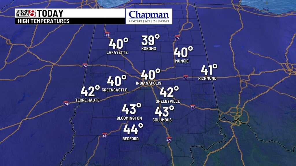
Some light sprinkles are still hanging around this morning. Expect any leftover precipitation to move out by mid-morning. Cloud cover will be the rule for the rest of the day. Much colder temperatures with calmer winds today, with highs struggling to hit 40° this afternoon.

Sunday night:
Mostly cloudy, quiet and colder. Lows fall to the mid-20s.

Monday:
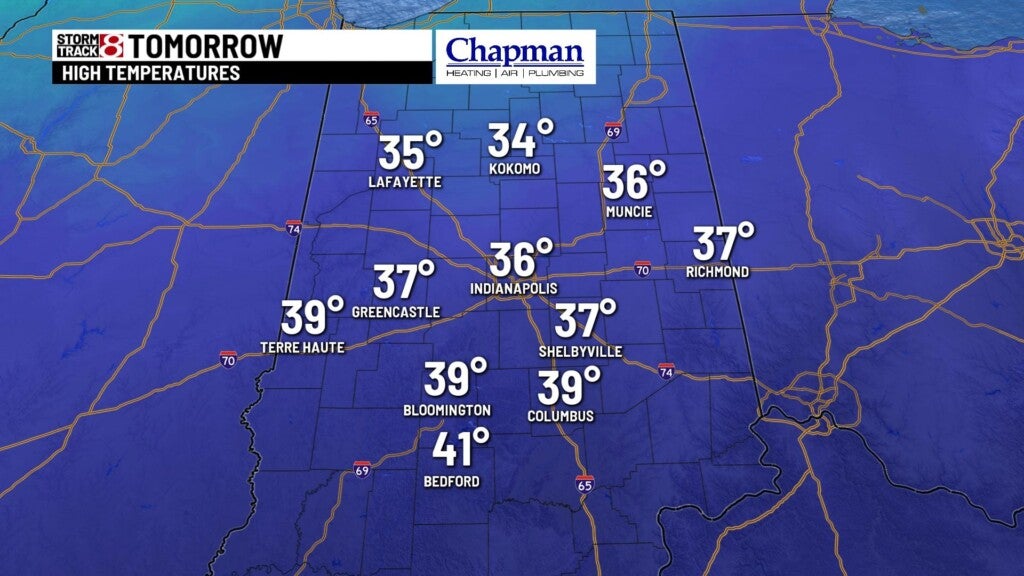
Gradual decreasing clouds should allow for sunshine to return by Monday afternoon. Despite that, temperatures will be chilly, with highs only in the middle 30s.

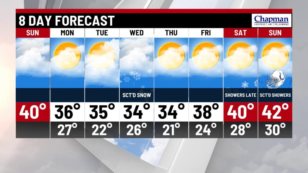
8 day forecast:
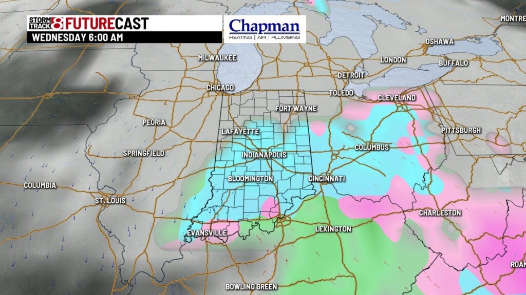
Quiet weather sets up through mid-week. A southern system will work through the Midwest on Wednesday, providing snow chances for much of central Indiana for the morning, possibly mixing with some rain by the afternoon. Still a little too early for numbers, but some lighter accumulations will be possible, especially for the southern half of the state.
Meanwhile, we’ll remain below average temperature wise through the majority of the week. We should see a minor rebound into the 40s next weekend as another system approaches, bring rain chances to our area Saturday night into Sunday.