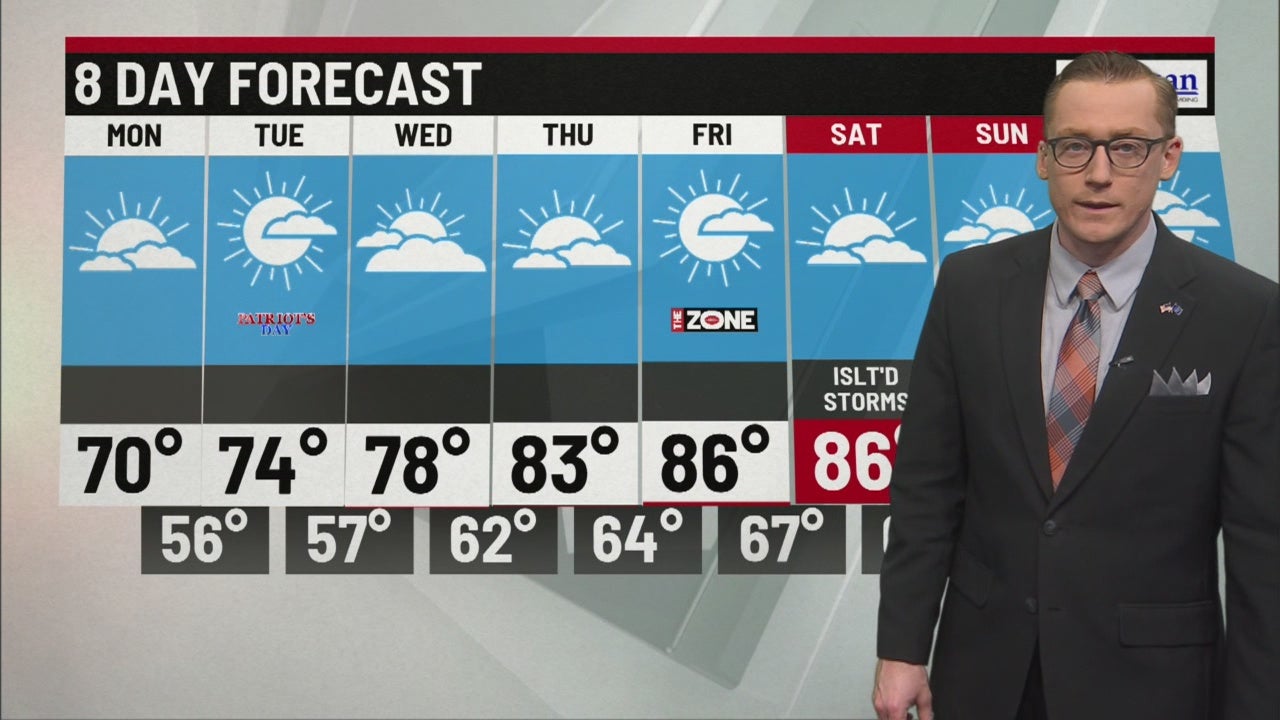
Skies will clear out for the work week, allowing temps to rebound
INDIANAPOLIS (WISH) — Good Sunday evening, everyone! We have seen a waterlogged 72 hours or more here in central Indiana. Most areas picked up at least 2” of rain total with several more along and south of the I-74 corridor having picked up more than double that just yesterday. Officially here in Indianapolis, we saw 4.63” from Thursday night through 2pm this afternoon.


High temperatures this afternoon were also rain cooled and nearly 20 degrees below average!

Skies will try to dry out this evening a bit and with clearing skies and a north wind, we’ll bottom out in the mid 50s by daybreak Monday.


Outside of the chilly start, we will not have many weather problems to deal with Monday, which is great news for the rescheduled Brickyard 400 which is set to start at 2pm tomorrow.


High temps Monday afternoon will only top out in the low 70s in most areas under a mix of clouds and clear skies.

Patriot’s Day, Tuesday, looks even better yet with more sunshine. With extra, free vitamin-D, temps will rebound into the upper 70s.

We’ll continue to climb the temperature stairs through the end of the work week with highs reaching the mid to upper 80s for this week’s high school football games.

The tropics are also warming up with 3 named systems in the Atlantic basin. Florence, a category 1 storm, will slide towards the east coast by the middle to end of this work week. If it does stall out, as potentially hinted at by many weather forecast models, it could lead to disastrous flooding along the coast and inland as far as West Virginia.


Here in central Indiana, we will see plenty of sunshine over the next 8 days, just when we needed it most. Temps will climb into at stay in the mid to upper 80s until another cold front knocks highs down by early next week.
