


Cloudy and cooler Tuesday
INDIANAPOLIS (WISH) — Briefly cooler temperatures move into central Indiana. The hottest air of the year is waiting for us at the end of the extended forecast.
Tuesday:
Upper level low will be camping out just to our north, which will bring us a lot of cloud cover for much of the day. A few light showers can’t be ruled out from time to time, but we shouldn’t see anything too measurable.

High temperatures will be running 10-15° below average, topping out in the low/middle 70s.


Tuesday night:
A few leftover sprinkles could be around for the early evening, otherwise expect partly cloudy conditions and cooler temperatures. Lows will dip down to the mid 50s overnight!

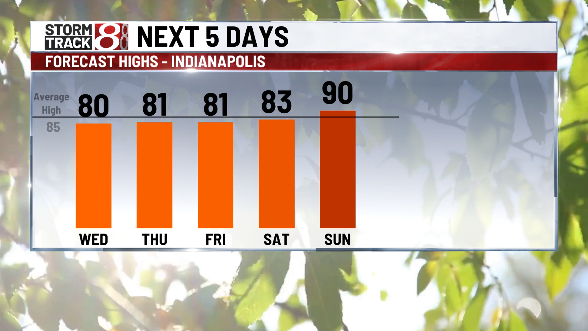
Wednesday:
Beautiful day on tap. We should see sunshine from start to finish. Highs will reach the upper 70s/lower 80s.

Thursday:
A quick hitting trough digging through the state may spark a few showers and storms across the state. There is a possibility that a few storms could be on the strong side, depending on timing.

Highs top out in the lower 80s.

8 day forecast:
Temperatures will remain pleasant through the start of the weekend, with highs holding around the lower 80s. Hot air with high humidity will build back in starting Sunday, with highs jumping to the lower 90s. Potentially the hottest air of the season moving in for the first half of next week, with highs in the middle 90s.

