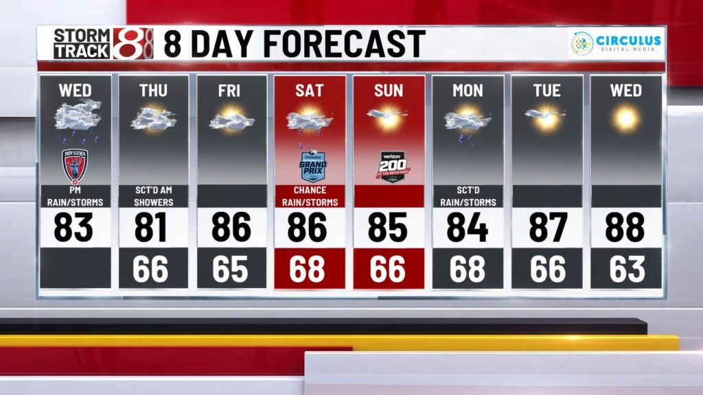
Rain and storms return Wednesday afternoon and evening
INDIANAPOLIS (WISH) — Soggy setup with the potential for a few strong storms heading into the second half of the day.
Wednesday:
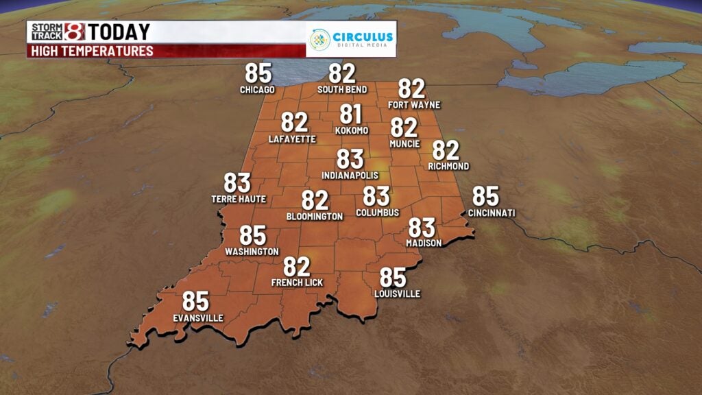
Dry start to the day, with a few clouds and comfortable temperatures. Highs will top out in the lower/middle 80s through the afternoon.
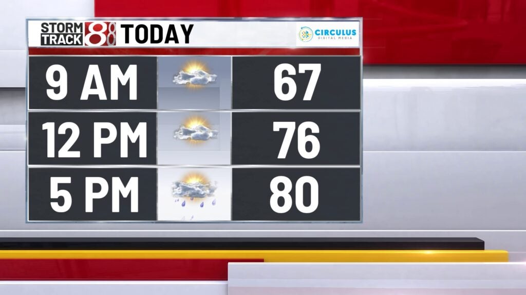
A trough will dig through the region this afternoon and evening – with central Indiana on the northern flank. This should keep much of the severe weather threat to our southwest, but will still aid in heavy rain potential. That said, much of central and southern Indiana is under a marginal risk for severe storms, with damaging winds the primary threat.
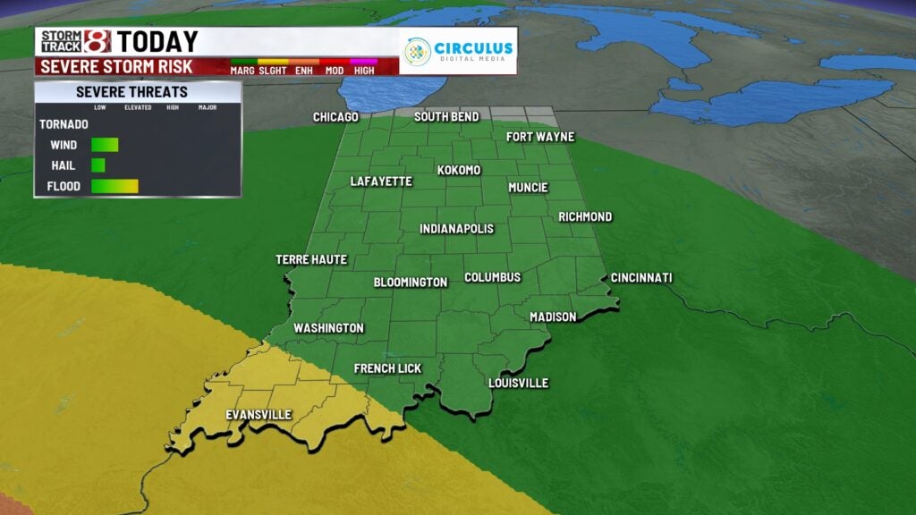
Timing: A few storms could start to fire as early as the early/mid afternoon hours, but thinking is the bulk of the evening will start as early as late afternoon and ramp up for the evening hours. Our heaviest rain threat will occur during this time. There is a slight risk for some flash flooding for areas that pick up several heavy rain makers, but widespread flooding should not be an issue.
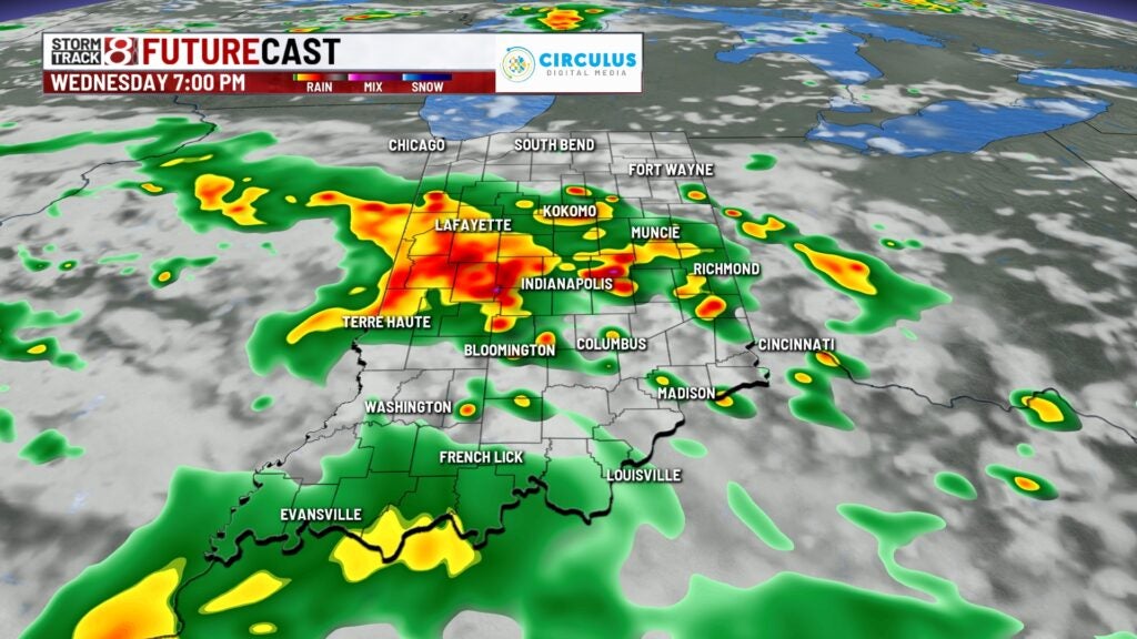
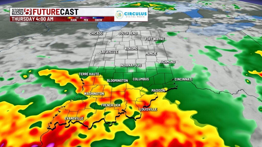
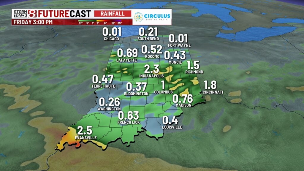
Futurecast has between 1-2″ across the area.
Wednesday night:
Rain will gradually taper off as we head into the overnight. We may have a few lingering showers around for daybreak, Thursday.

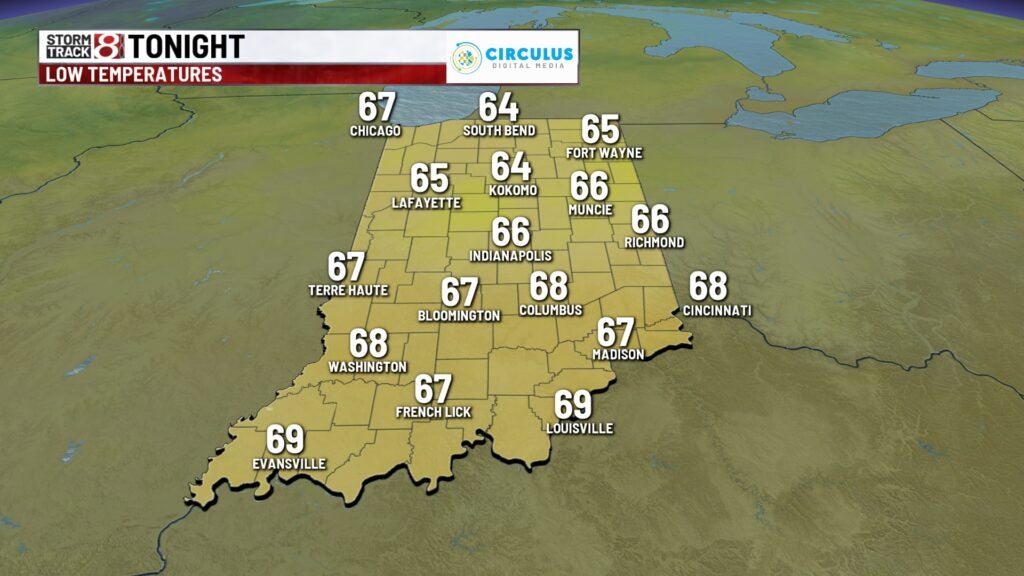
Lows fall to the mid 60s
Thursday:
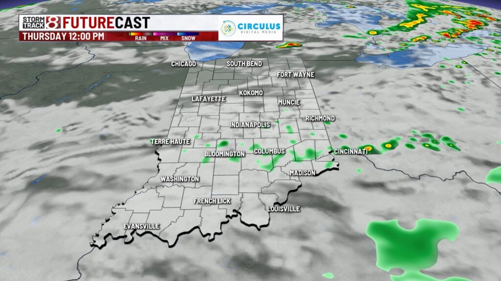
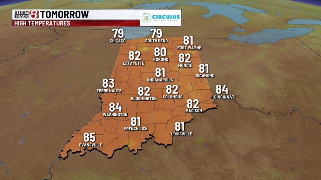
Just a few left over showers around for Thursday morning, otherwise we’re partly cloudy and comfortable, with highs in the lower 80s.
Friday:
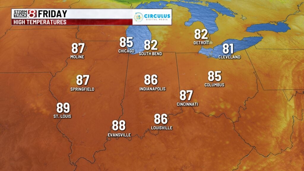
Should be a nice day – with warmer temperatures and a little more humidity. Highs top out in the mid 80s.
Weekend:
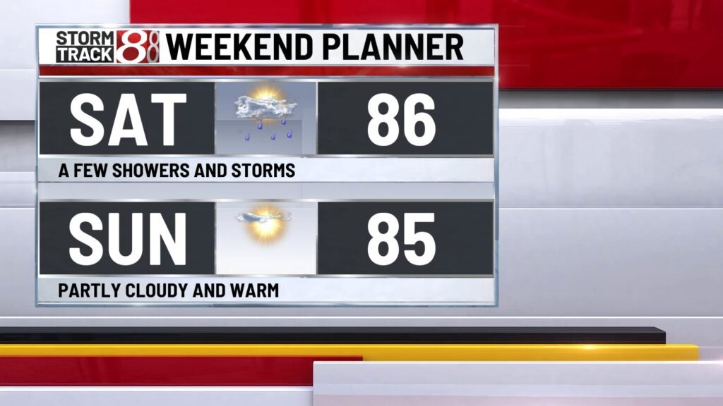
A weak boundary moving through overnight Friday into Saturday morning may spark a few showers and storms for the first half of Saturday – but should not be a wash out of a day. Conditions look relatively dry on Sunday. Both days will produce near normal temps.
8 day forecast:
Hints of a slight warming trend early next week after a Monday convective system. Numerous showers and storms appear possible Monday. High temperatures may push close to 90° by the middle of next week.
