
More rain with possible flooding issues Wednesday
INDIANAPOLIS (WISH) — We’re tracking another round of showers and storms Wednesday with near normal temperatures through midweek.
Tuesday night: We can’t rule out a few spotty showers through sunset. Then, we’re dry for the overnight hours. Lows in the mid 60s.


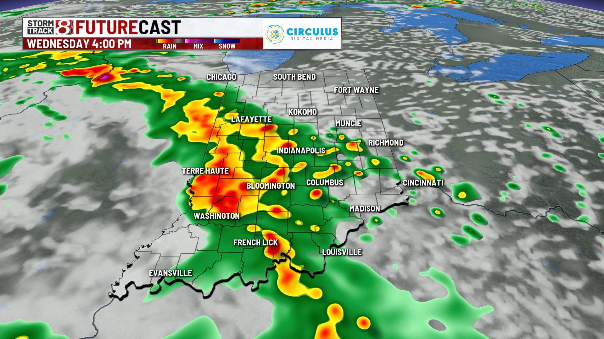
Wednesday: Expect a dry start to Wednesday before widespread showers and storms slide in by the mid-afternoon hours. Additional development will carry through into Wednesday night.


There is potential for isolated strong to severe storms during the afternoon and nighttime hours with damaging winds as the primary threat. We can’t rule out an isolated tornado southwest of Indy. There will also be flash flooding concerns along and south of interstate 70 for areas that receive training heavier rain.


Highs in the low to mid 80s. It will also feel more humid once again as the muggy meter rises back up.


Thursday: A few showers and storms may persist into Thursday morning. Then, we’ll see dry weather take over for the remainder of the day. Skies turn mostly sunny to partly sunny in the afternoon hours with highs in the low 80s. Despite a light breeze out of the north, humidity values will unfortunately remain on the higher side.

8-Day Forecast: A warm and humid close to the workweek will be ahead for Friday. By Friday night into Saturday morning, another weather maker looks to slide in with more scattered rain and storms. It is too early to determine if this system will bring severe weather. Highs look to be in the mid 80s through the weekend with a high muggy meter remaining in place.
