


Quickly gearing back up for streak of rain and storm chances this week
INDIANAPOLIS (WISH) — We got to enjoy the best day one could ask for with the solar eclipse today. Unfortunately, dry air will not hang on too long once again as a series of rain and storm chances are ahead this week.
Monday night: We’ll turn partly cloudy for tonight with winds staying light out of the south. Lows will dip into the mid 50s.

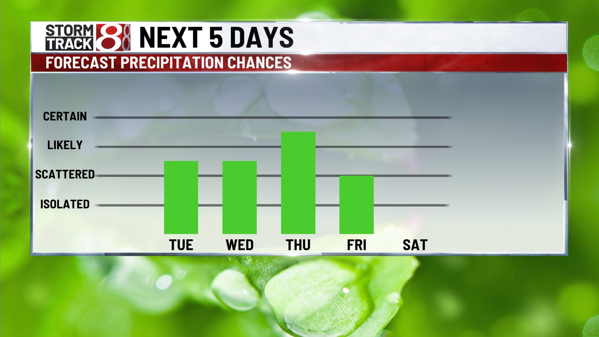
Tuesday: A dry start to our Tuesday is expected with more cloud cover in place. This will change as a cold front inches into our area from the west. Scattered showers and a few rumbles of thunder are possible Tuesday afternoon and night.


Highs will still manage to get into the upper 60s to low 70s.

Wednesday: The chance for rain will only increase through midweek as the aforementioned front starts to stall out. Showers (possibly some storms) turn likely by the second half of Wednesday as a low pressure system begins to slide in from the southwest. Some moderate to heavy rainfall could occur going into Wednesday night.
We’ll turn slightly cooler on Wednesday due to the nearby front with highs in the mid to upper 60s.

8-Day Forecast: The potential for bouts of heavy rainfall and some storms will persist through Thursday. This also means that flooding concerns will once again be on the table just like last Monday into Tuesday. Some showers will linger into Friday as well with highs dropping into the upper 50s to low 60s. At this time, we’re eyeing roughly one to two inches of rain from Tuesday until the end of Friday with some spots receiving higher amounts. It will also turn a bit breezy Thursday and Friday especially with gusts over 30 MPH at times. Then, temperatures quickly rebound back into the 70s by this weekend.

