Storms for Fourth of July, less muggy by this weekend
INDIANAPOLIS (WISH) — We are tracking an active and muggy Fourth of July with the hope of activity dwindling by Thursday night.
Wednesday night: Scattered showers and storms will gradually shift towards southern Indiana as we go throughout tonight.


There is still a Slight Risk (level 2/5) in place for mainly the southern half of the state heading into tonight. The best chance for severe storms will be in the southern third of Indiana. Damaging winds will be the main concern.

Expect another warm and humid night with lows down in the low 70s.


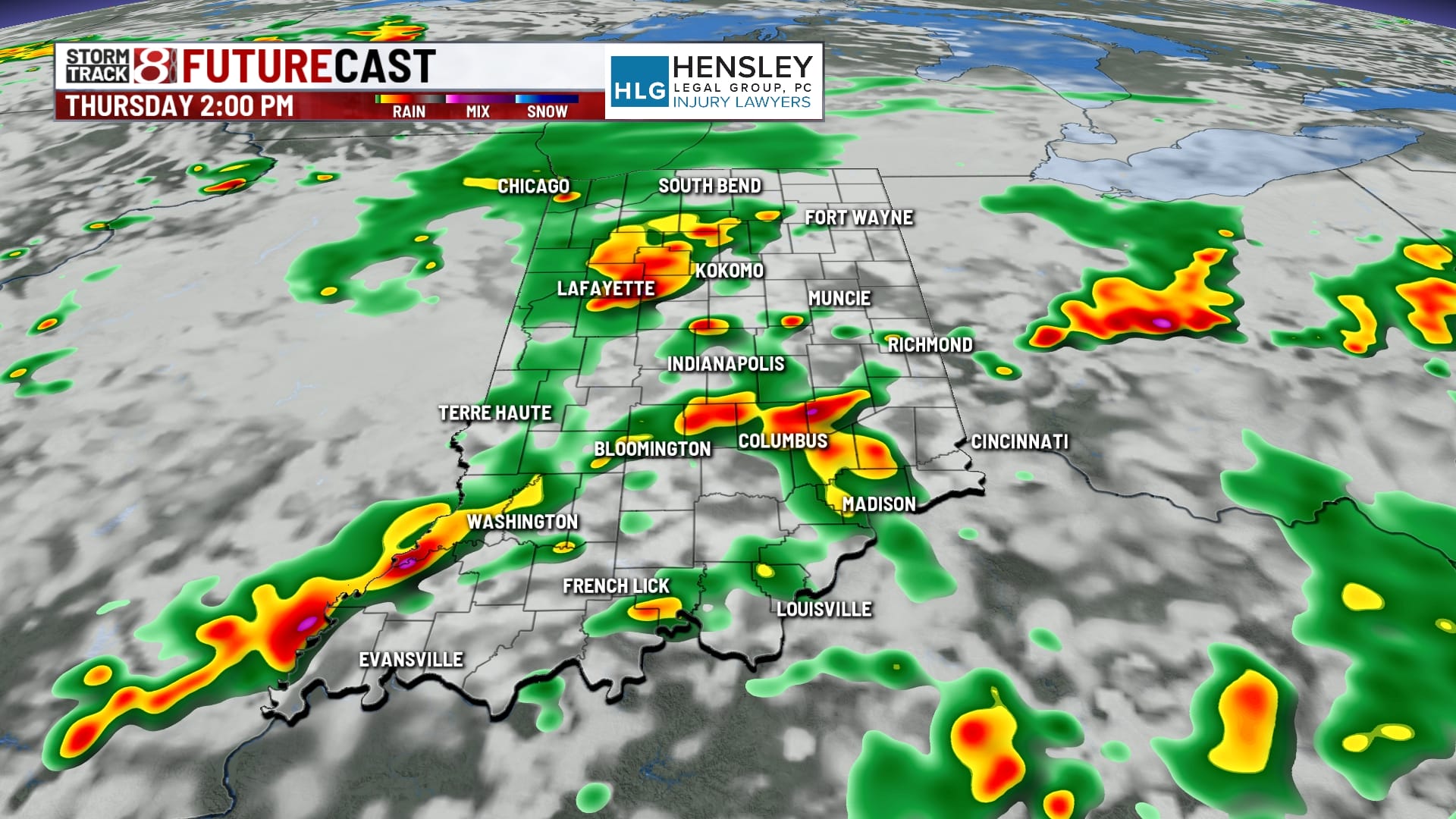
Fourth of July: Active weather will be on deck for a good chunk of your Thursday. Showers and storms look to be on and off with bouts of heavy rain at times. We’re expecting things to clear out close to or around sunset, which would be just in time for the main stint of Independence Day activities to take place.


A low level 1/5 severe risk is in place for mainly the southern third of Indiana. Damaging winds will be the main threat once again. Some flooding could occur if repeated rounds of heavier rain over the same areas occur.

Highs will struggle to get into the low 80s due to the cloud cover and rain. There could be a few peeks of sunshine Thursday evening, but that may be asking for too much.


Friday: More showers and storms will be possible for mainly the first half of Friday before a slightly stronger front passes through. By the second half of Friday, we’ll see the muggy meter drop a little bit with skies clearing out.


Highs will get into the low to mid 80s.

8-Day Forecast: The first weekend of July is not looking half bad. Saturday will feature plenty of sunshine and dry conditions with highs in the low 80s. Highs look to be right around normal by Sunday with numbers in the mid 80s. The only slight setback with this weekend will be that humidity values are set to be in the uncomfortable range, but not too miserable. Additional rain and storm chances are ahead by early next week.


