Tracking a severe risk Wednesday

INDIANAPOLIS (WISH) — We are currently watching out for an elevated threat of severe weather for Tuesday afternoon and night. There is also a severe weather risk for Wednesday.
Then, we’re talking cooler air with continuing rain chances the rest of this week.
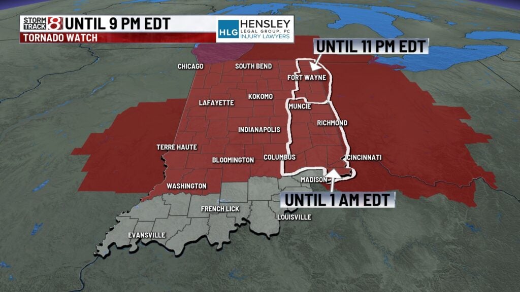
A ***Tornado Watch*** remains in effect until 9 PM EDT for much of Indiana. Tornado Watches have also been extended eastward.
Tuesday night: Scattered showers and storms will be ongoing into this evening and tonight.


There remains an Enhanced Risk (level 3/5) of severe weather until roughly 10 PM EDT tonight as storms continue to shift east. All hazards are possible with large hail, damaging winds, and possibly tornadoes.

Some of these storms could turn intense with even the potential for strong tornadoes (EF2+) and significant sized hail over two inches in diameter. This is if storms can stay discrete.
Lows will be down into the upper 50s to low 60s.


Wednesday: Unlike Tuesday, we will see a dry slate of conditions through Wednesday morning. However, more showers and storms are ahead in the afternoon and nighttime hours.


There is another elevated threat of severe weather on Wednesday for areas along and south of interstate 70. Areas along and south of a Spencer-Columbus line are in an Enhanced Risk (level 3/5) while areas within most of central Indiana sit in a Slight Risk (level 2/5) of severe weather. All hazards will once again be possible with damaging winds and large hail (some possibly significant – in dark shade) the primary threats. Tornadoes cannot also be ruled out, but the higher tornado threat at this time sits in southern Indiana.


Heavy rainfall will also occur at times with these storms, so some flooding issues may arise.
Highs in the low 80s.


Thursday: A few showers and storms are possible during the daytime hours, but overall, expect a cooler and breezy Thursday.
Highs will top out in the low 70s with wind gusts up to 25-30 MPH at times.

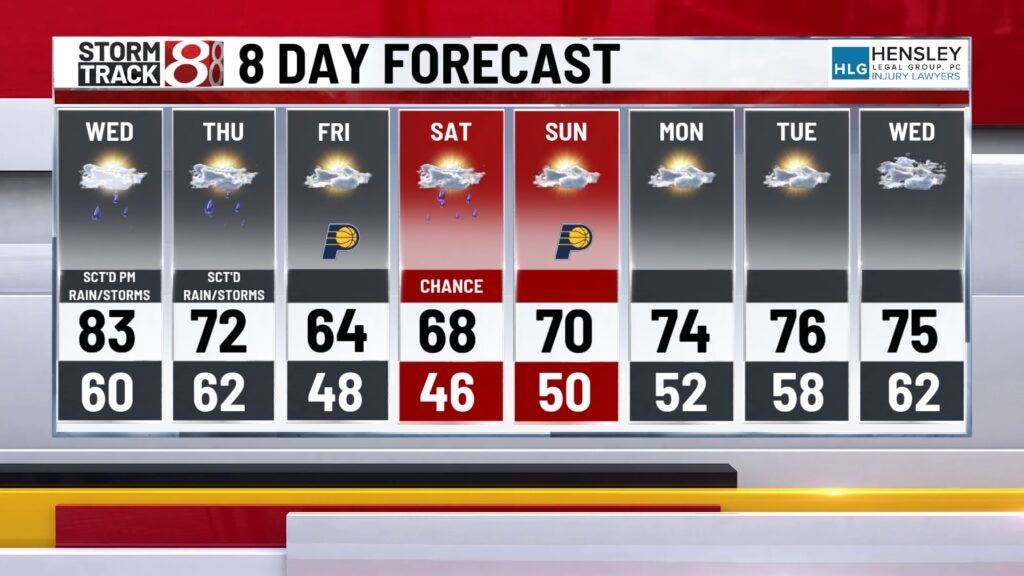
8-Day Forecast: Rain chances will remain with us through Friday and this weekend. Saturday will feature a better chance for rain and possibly isolated storms as opposed to Mother’s Day on Sunday. The Saturday rain is not friendly news for those who plan on heading to the Indy Grand Prix. Temperatures turn below average with highs in the mid 60s on Friday and Saturday. We’re back in the 70s by Sunday and into early next week.