Revisiting a historical central Indiana flood that ended the year 1990 in chaos
INDIANAPOLIS (WISH) — One of central Indiana’s biggest flooding events happened more than 30 years ago, ending 1990 on a chaotic note.
Most of Indiana would end up being affected by this major flood as a combination of snow melt and rainfall caused rivers and streams to excessively overflow and forced thousands of evacuations.
Lowland, river flooding was already ongoing due to above-average rainfall through the first three weeks of December 1990. There was quite the buildup to the eventual widespread flood that all got started with a system that brought snow and sleet from Dec. 22-24 across the entire state. Snow depths ranged from 7-8 inches in northern Indiana and 3-4 inches in central and southern Indiana.
Arctic air arrive for Christmas Day, freezing the ground to a slight degree.
Another snow maker arrived Dec. 27. It dumped several inches of snow in central and southern Indiana.
Then, a major warmup quickly moved in Dec. 28-29 that brought plentiful moisture along with it. This caused not only a fast snowmelt, but also led the way for Dec. 29 to be very rainy. What’s also important to note is that the snowmelt turned into up to an inch of liquid water than ran off into streams due to saturated ground.


Rainfall amounts on Dec. 29 were up to 3 to 4 inches across much of the Hoosier state. Colder and drier air infiltrated the state by the night of Dec. 29 and into Dec. 30, and this caused rain to change over to snow. Several more inches of snow would fall in northern Indiana.
The rain and snowmelt would ultimately give way to flooding in some areas of Indiana that had not seen it in over 30 years.
Widespread flooding would transpire in which several rivers had near-major to major flooding. The saturated ground conditions, recent floods and partially frozen ground allowed the water no place to go except into the streams. The rapid snowmelt and continuous rainfall over 24 to 36 hours allowed the overflowed small streams to feed the rivers for an extended period of time. As a result, nearly every stream and river flooded extensively.
The overall controlling factor for the severe flooding was the amount of rain that fell. For example, areas that ended up receiving a combined total of rain and liquid snow melt from 3½-5 inches had life-threatening flooding. Some of the rivers that had life-threatening flooding included Kankakee, both Eels, Maumee, Wabash, Mississinewa, Salamonie, White, Whitewater, East Fork White and Muscatatuck.
Here are some of the highest river and creek crests that were observed across central Indiana:

To further break down how this event became historic, here are additional stats from the flooding on the rivers and creeks mentioned in the previous graphic:
- White River at Indianapolis (East Raymond Street): highest crest since 1964; eighth-highest all-time.
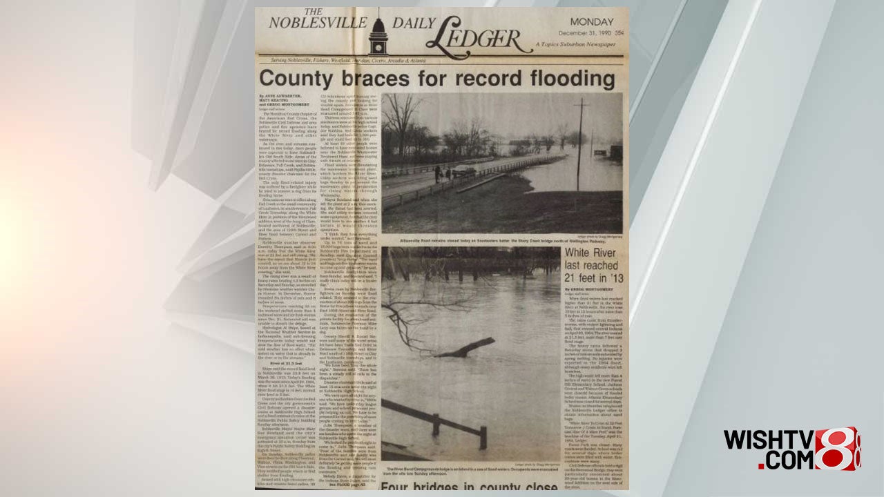
- White River at Noblesville: highest crest since 1964; fourth-highest all-time.
- White River at Anderson: highest crest since 1964; eighth-highest all-time.
- White River at Centerton: highest crest since 1913; fifth-highest all-time.
- Wildcat Creek at Kokomo: highest crest since 1959; fourth-highest all-time.
- Big Blue River at Shelbyville: highest crest since 1937; eighth-highest all-time.
Over 2,000 homes with 4,000+ people had to evacuate, and 1,700 structures were damaged. Three people died due to the flooding.
It is very crucial to note that nearly all of Indiana’s floodplains are flat. Why is this important? The arctic air that settled in through Dec. 30 would end up lingering through the first few days of 1991. This cold air contributed greatly to the flood disaster as floodwaters froze and left ice several inches thick in homes and on roads.
Homes that were evacuated and had their heat turned off had frozen water pipes. Ice was treacherous to the point that some residents could not return to their homes immediately. The hardest hit areas were Marion, Howard and Hamilton counties. Nearly 1,000 homes had first-floor flooding. At least another 1,000 homes were affected or threatened by possible levee failures. Areas flooded in these counties included Ravenswood, Riverwood, Trails End, Noblesville, southwest Indianapolis, and Kokomo.
Due to the extensive nature of this cataclysmic flood, 72 of 92 Indiana counties declared disaster areas. Flood damages ranged from $50 million to $100 million.