Storm Track 8 blog: Severe storms in central Indiana
Interactive radar | Latest forecast in weather blog | Closings and Delays | Storm Track 8 weather app | Watches and warnings | Hourly forecast | Wind gusts | Check the Indiana Travel Advisory map
INDIANAPOLIS (WISH) — Severe thunderstorms began popping up in central Indiana on Tuesday afternoon.
9:59 p.m.
The National Weather Service reports, “More showers and storms in E IL approaching IL/IN border should reach the border between 11:15 and 11:45 PM based on movement as of 9:41 PM EDT. Wind gusts up to 50 mph and hail to size of dimes along with heavy rain and lightning to contend with.”

7:54 p.m.
Noblesville Fire Department reports on social media that two reports of lightning strikes were reported during a brief storm Tuesday evening. Two homes received minor damage. No one was injured.


7:19 p.m.
Poweroutage.us reported 2,225 Indiana customers without power.
6:54 p.m.
6:08 p.m.
5:47 p.m.
5:03 p.m.
4:44 p.m.
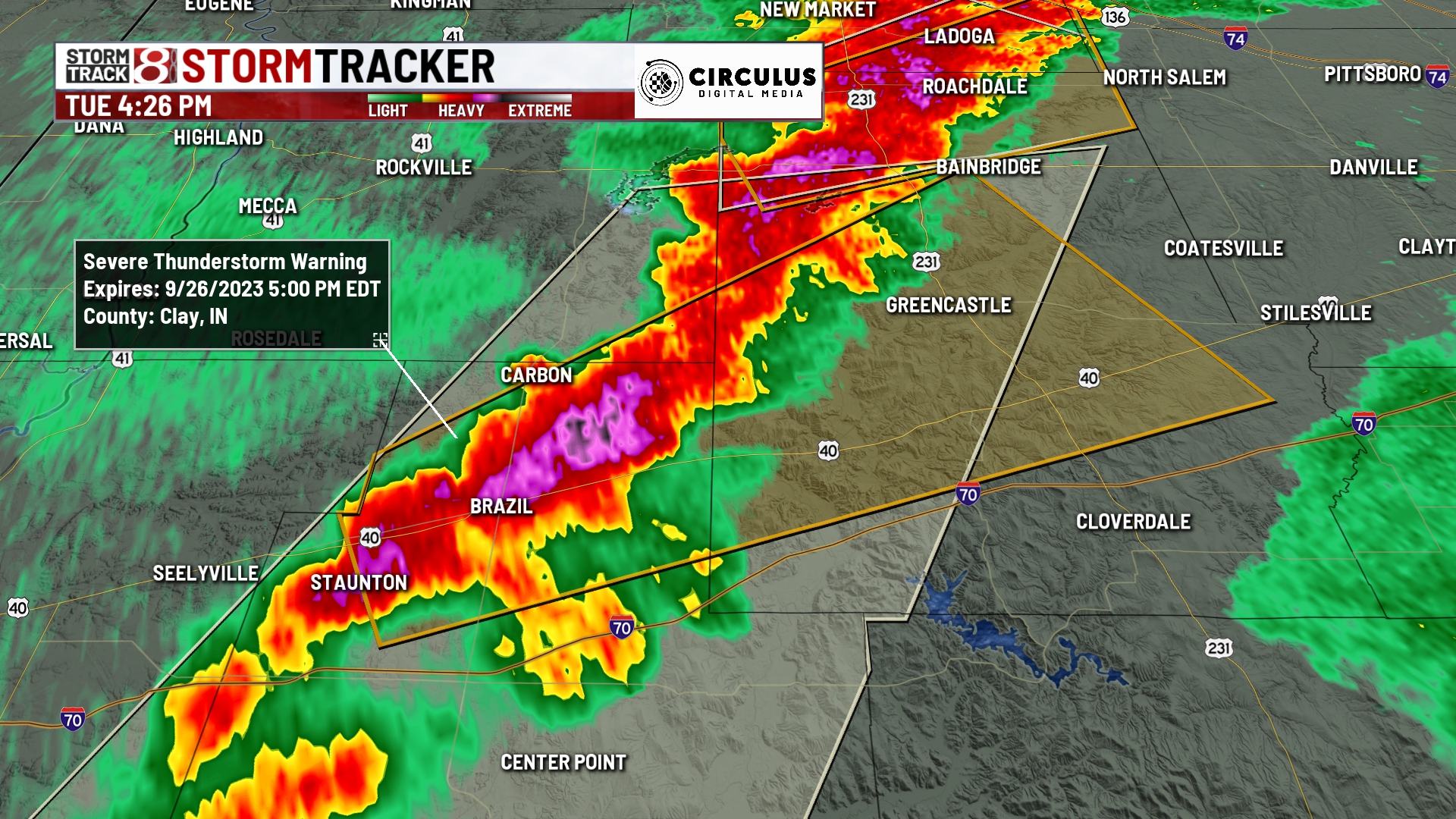
4:32 p.m.
4:25 p.m.

4:22 p.m.
From the Storm Track 8 team: “Line of storms below the severe thunderstorm warning has turned stronger with the potential for half inch hail and gusts up to 50 MPH. Indy looks to start seeing activity ramp up within the next one to two hours if this all holds together”

4:19 p.m.
4:16 p.m.

4:06 p.m.
3:53 p.m.
3:37 p.m.
