Stormy Thursday to be followed up with colder air returning
INDIANAPOLIS (WISH) — We have already seen a round of showers and thunderstorms with some severe thunderstorm warnings occurring late Thursday morning into early Thursday afternoon. We’re monitoring the better chance for severe weather for Thursday evening and night.
Then, we’ll watch temperatures drop off a bit going into the weekend with even colder air flying in by the start of next week.
A ***Tornado Watch*** remains in effect until 12 AM EDT tonight.

Thursday night: The last round of showers and storms this evening and tonight will be carefully watched for the possibility of strong to severe storms. Severe threat timeline looks to be mainly 5 PM – 12 AM EDT across central and southern Indiana.


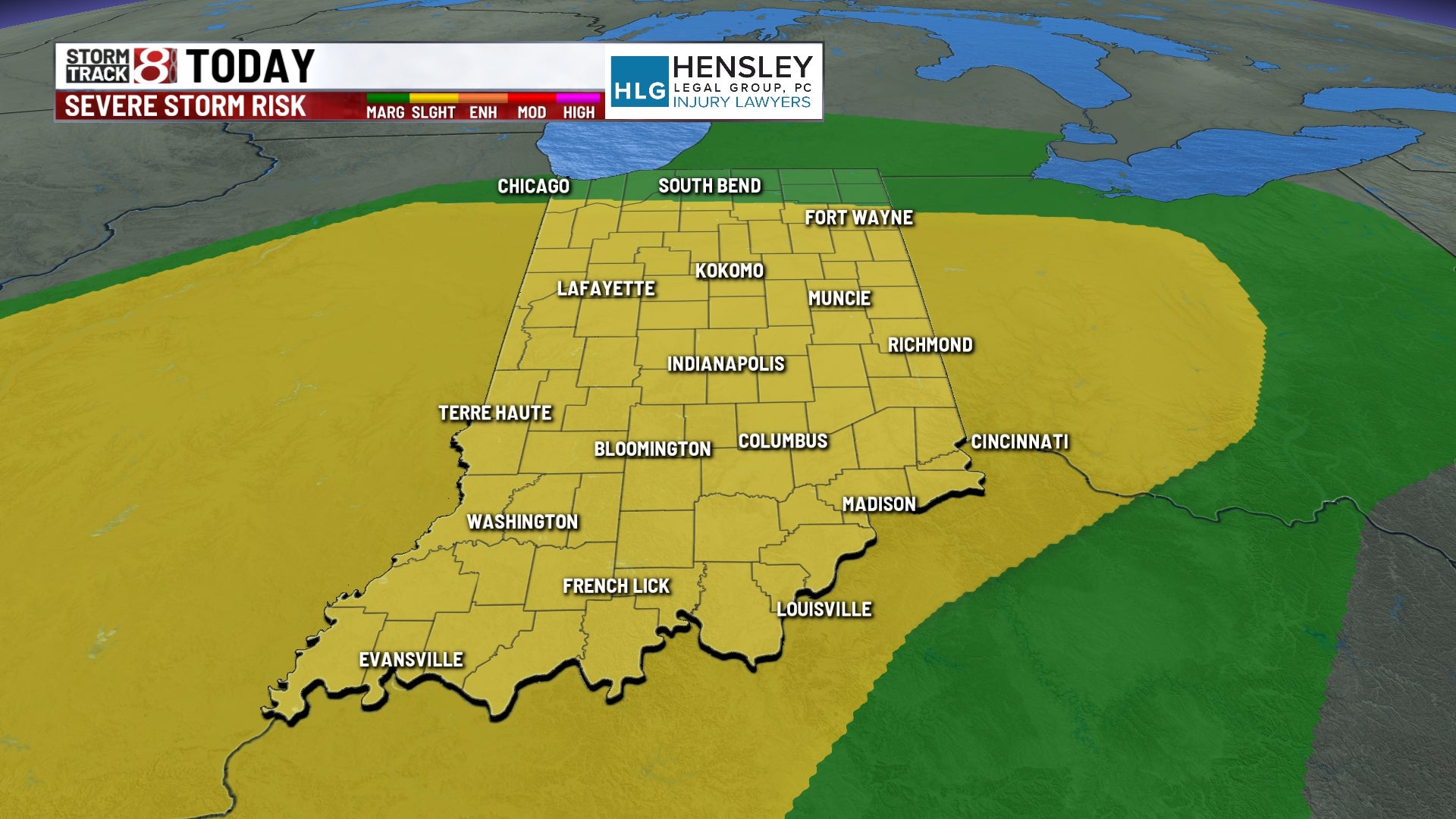
A Slight Risk (level 2/5) of severe weather is in place across most of Indiana. Damaging winds and large hail with be the primary concern, but isolated tornadoes and localized flooding are also threats. There could even be significant sized hail (2″+ in diameter; highlighted in dark shade).


Lows will fall into the low 50s.


Friday: Some lingering light rain/drizzle will stick around into Friday morning before we clear out all precipitation by Friday afternoon. Skies will also remain cloudy until we get towards Friday evening/night. Temperatures are expected to struggle getting into the mid 50s in the afternoon hours after we see highs take place at midnight. Those highs will be in the low to mid 60s.


Saturday: We’ll get back on the sunshine train for Saturday. In addition to skies turning mostly sunny, winds will pick up out of the southwest with gusts up to 25-30 MPH. Highs will manage to get into the upper 50s.

8-Day Forecast: After a near 60 degree day on Saturday, a cold front will come through Saturday night and knock our temperatures down even further for Sunday. Highs will struggle to get out of the 40s with breezy winds out of the northwest. It will only get colder by Monday with highs only able to rise into the upper 30s. There could even be a few snow showers on Monday as well. We’ll see temperatures rebound quickly going into the middle of next week.
