Shower chances Friday, much cooler weekend ahead | Sept. 6, 2024
INDIANAPOLIS (WISH) — Highs will struggle to get out of the 60s for some this weekend.
This morning:
Clouds are slowly starting to increase from the north ahead of a weak cold front dragging in from the northern Great Lakes. Temperatures still remain on the mild side for now on the front end of this cold front.


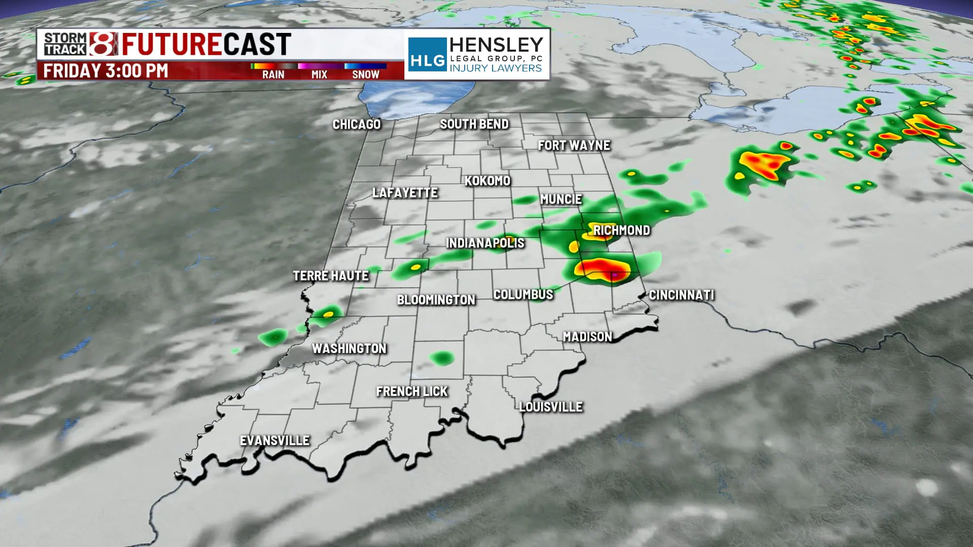
Friday:
A cold front will march through the state as we roll through the day today, bringing with it mostly cloudy skies and some scattered showers for the afternoon hours. There is a slight thunderstorm chance that will likely be more in the southeastern portions of the state for later this afternoon.


There is a chance for a few gusty thunderstorms in Southeastern Indiana.

Highs top out around 80 for the early afternoon, falling back after the cold front pushes through the state this afternoon.


Friday night:
Rain should pull away by mid- to late afternoon, allowing for dry conditions for the evening and overnight. Much cooler temperatures are going to be filling in behind the cold front. Under mainly clear skies, expect lows to dip into the upper 40s and lower 50s overnight.

Saturday:
Chilly and dry start to your Saturday morning with some blustery winds. Gusts could get up to around 20 to 25 mph at times. Nice Highs will top out into the upper 60s to around 70°.


Saturday night:
Very chilly temperatures overnight, as many areas will see lows dipping down to around 40. In far northern portions of the state, we could see a few areas slip into the upper 30s. It’s unlikely that we’ll see any frost, but some sensitive vegetation that really doesn’t like the chilly temperatures could be at risk for the overnight hours.

Sunday:
Quiet end of the weekend with sunshine and breezy conditions. Temperatures should warm just a bit compared to Saturday, with highs into the low to mid 70s.

7 day forecast:
The extended forecast presents a warming trend building through much of next week. Upper-level raging will allow for dry weather to continue and temperatures to climb back to the 80s as early as Monday. We’ll likely see middle 80s returning by the middle of the week and some indications of near 90° temperatures by late next week.

Hot & dry pattern continues:
There are also some signs that we may not be done with summer heat. The new 8- to 14-day outlook shows a very strong signal for above-average temperatures through the middle of the month.

Meanwhile, drought conditions are expected to build more. Most of the state is now considered abnormally dry, and not many rain opportunities are in the forecast over the next two weeks.

