Increasing clouds Thursday, rain from Francine arrives into Friday
INDIANAPOLIS (WISH) — Although today was a warm one, it did not feel too miserable thanks to very low humidity remaining in place.
Focus is shifting towards Francine and how it may bring needed rain to us heading into this weekend.
Wednesday night: We’re tracking a quiet, mostly clear, and cool night with lows in the upper 50s to low 60s.


Thursday: Another warm day will take place for our area. The notable difference with tomorrow, however, will be increasing cloud cover as Francine inches closer from the south. Showers look to infiltrate southern Indiana by late Thursday.


Highs will be in the mid to upper 80s.


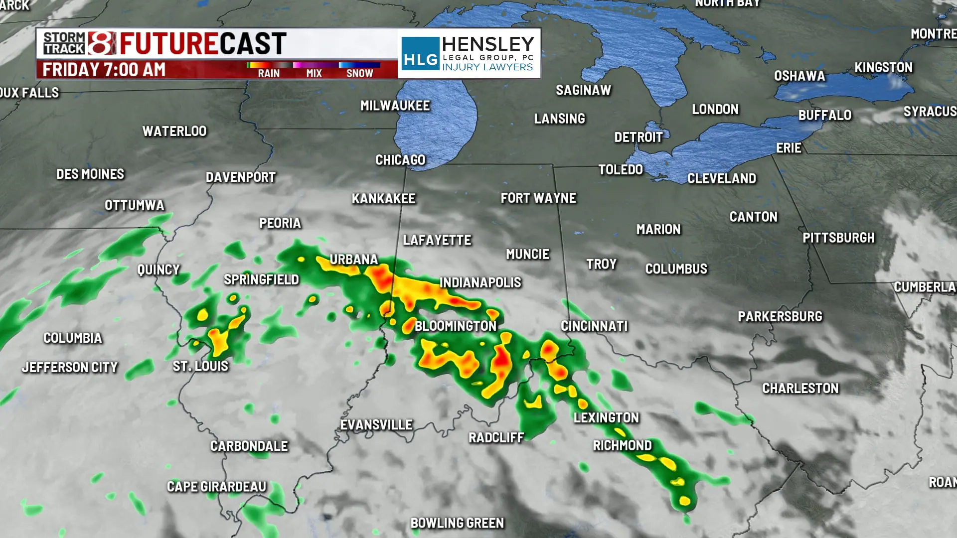
Friday: Francine’s rain bands will gradually drift northward into Friday with on and off weakening showers/isolated storms. There is uncertainty with how far north this activity gets due to two main things:


1.) Ongoing dry air that needs to be eroded.
2.) High pressure to our north that may keep rain further south than anticipated.
Regardless of how the rain plays out, we are talking a cooler and more humid day with highs only in the mid to upper 70s.

7-Day Forecast: Rain chances begin to lessen Saturday as Francine begins to break apart. We may even have a very small lingering rain chance Sunday. Rain totals are going to feature a sharp cutoff from south to north with the highest amounts set to be in southern Indiana.

Temperatures look to quickly get back into the 80s this weekend with an elevated muggy meter expected. At this time, we’re going with a mainly dry forecast for next Tuesday and Wednesday. The reason why this is being emphasized is because there could be remnants from another tropical system that slides in from the Carolinas. However, there is large uncertainty on how this all evolves.
