
Recapping the early February 2022 winter storm one year later
INDIANAPOLIS (WISH) – One year ago, much of the Hoosier state underwent one of the bigger winter storms that we’ve had in recent memory. Some locations wound up receiving over a foot of snow.
As we approached the last couple days of Jan. 2022, models we’re consistently signaling a big system that would bring major to extreme impacts. By the morning of Wednesday, Feb. 2, a system that sat in upper Quebec, Canada had a front extending through Indiana with the polar jet stream sitting just behind the front. The front would slowly progress southeastward going into Thursday, Feb. 3, and the jet stream followed closely behind, which dragged colder air and heavy snow from north to south.

Northern Indiana was gripped with heavier snow staring early on Feb. 2, and the big question throughout the day was how far south was the freezing line going to go. The changeover from rain to snow featured a little bit of mixed precip, which caused roads to slicken along with the snow. Winds were also breezy, which caused very low visibilities.
By Wednesday night, the freezing line was at a crawl near interstate 70. Areas along and south of interstate 70 would then pick up on the brunt of the heavy snow on Thursday. Ice and sleet accumulation was more prevalent south of interstate 70 on Thursday as well before those locations got in on a little bit of snow.
The amount of snow that accumulated especially in the northern third of the state would cause travel to become highly challenging, and in some cases impossible. Snow totals were highest in the northern third of the state because that is where heavy snow lasted the longest and didn’t deal with much of other precip.
Here is a list of some of the snow totals that were observed in the jurisdiction of NWS Indianapolis:


Here are also some of the highest snow totals that were observed in the jurisdiction of NWS Northern Indiana:


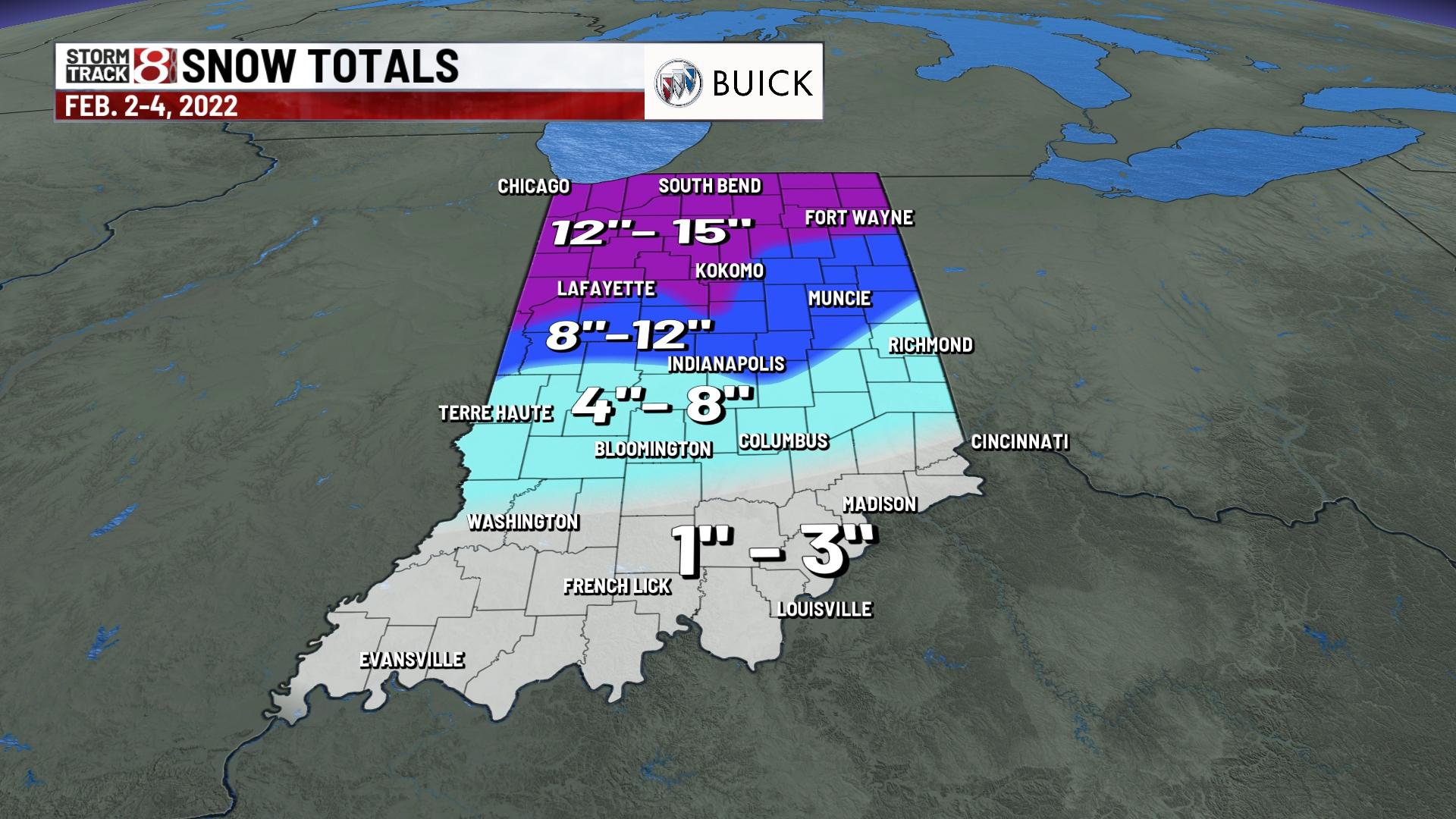
Here is the overall snow map from Feb. 2-4:
