Severe storms will bring damaging wind and hail to southern Indiana today
INDIANAPOLIS (WISH) — Good Thursday morning! We saw a wet and windy day yesterday as what was left of Tropical Depression Alberto swept through central Indiana. Most areas saw at least a little bit of rain with far western portions of the state and Illinois picked up significantly more.


Alberto is moving out and we’re left with mild and muggy conditions as you head out the door and hit the road. A few isolated showers or storms are possible this morning, but better chances for rain will return this afternoon and evening.


Highs will climb into the upper 80s and low 90s with a mix of sun and clouds through the afternoon.


As temps heat up, storms will begin to develop through the early afternoon hours with better chances for more widespread wet and stormy weather through the late afternoon and evening hours.


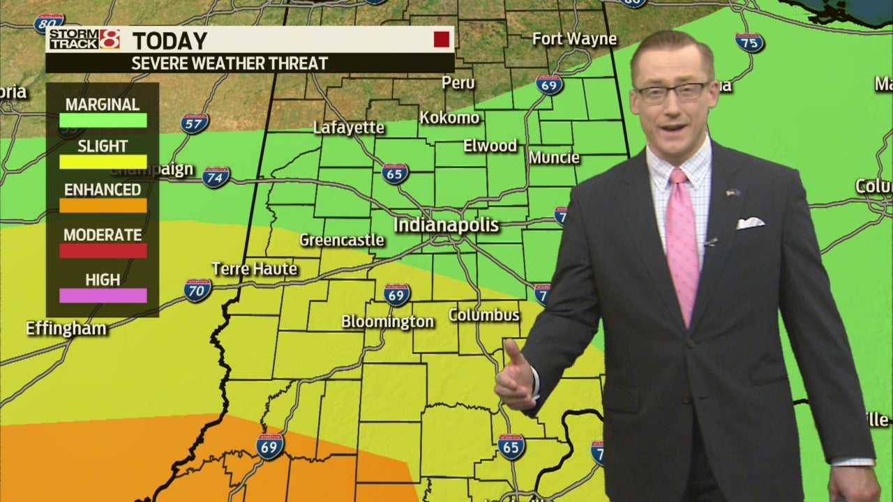
A SLIGHT Risk is in place today for severe storms with damaging wind and hail being the primary threats. We cannot rule out a tornado in far southern Indiana, so stay weather aware if you have to head that direction.


The best chances for strong to severe storms will be through the afternoon and evening hours.
By late this evening, storms will start to fizzle out. We’ll drop slowly into the low 70s by daybreak Friday.


After the mild start, temperatures will once again soar into the upper 80s tomorrow afternoon. A few lingering storms are likely, but Friday will not be a washout, so don’t cancel any plans.


The storms tomorrow will usher in slightly cooler air as we head into the weekend. The first half of the weekend will be a great opportunity to get outside and soak up the sun before isolated storms return by Sunday.


As we head back into next work week, temps will briefly return to the upper 80s Tuesday before another cool down spread in by mid-week. Our next best chance for any wet or stormy weather past today and Friday will hold off until this time next week.