Marvelous weather stretch through midweek, very little rain in sight going forward
INDIANAPOLIS (WISH) — We dealt with some showers for our Tuesday as a front progressed into the state. This front also cooled our temperatures down several degrees with highs only getting into the low 70s.
These nice temperatures are set to hang around for at least the next few days.
Tuesday night: Skies will turn mostly clear tonight in the wake of the cold front. Patchy fog will also develop overnight and into daybreak Wednesday. Lows will bottom out in the upper 40s to low 50s, so you will want the jacket if you’re heading out tonight.


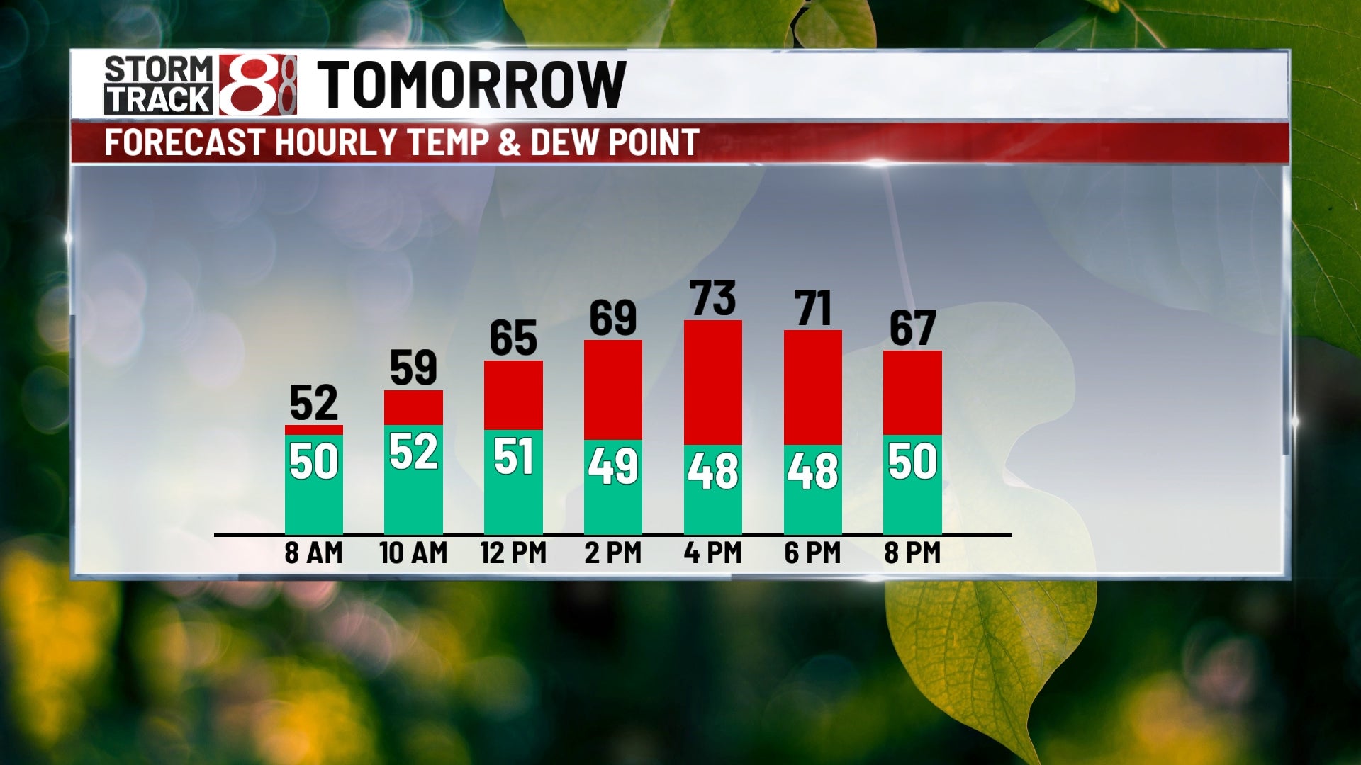
Wednesday: You’ll want the jacket on your way to school or work to start your Wednesday. We look to see a lot more sunshine as Tuesday’s system gets farther away from us. Even with the extra sunshine, highs will only manage to get into the low 70s. There is the potential for a few showers northwest of Indy in the afternoon hours, but it should be mainly dry regardless.


Thursday: We will keep feeling fantastic with lots of sunshine through our Thursday. Light winds out of the north will hold our temperatures from rising too much with numbers in the mid 70s.

8-Day Forecast: Friday will be the best weather day of the week with plenty of sunshine and highs in mid 70s. Slightly warmer conditions are expected Saturday. Then, clouds will increase Saturday night ahead of our next chance for rain. Spotty showers may develop on Sunday, and high temperatures will remain in the mid 70s. Another small chance for rain may arrive early in the new workweek next week.
