
Drought improving in Indiana, but flooding concerns may keep growing
INDIANAPOLIS (WISH) — Since having a well below-normal June in the rainfall department, we have made up a lot of ground in the past few weeks.
However, with this active pattern not looking to slow down anytime soon, we need to be weary of the possibility of increasing flooding issues going forward.
Let’s rewind in time to early July. At that point, we were coming off the heels of the 12th driest June on record with only 1.41 inches of rain recorded in Indy. There was also drought consistently building in the northwestern quarter of the state.
It all culminated with a good chunk of the northern half of the Hoosier state falling under a severe drought (level 3/5) by the July 6 update. After this specific drought update, we began to make a big turnaround by receiving multiple weather systems every week through the rest of July.

This led way to Indy for instance seeing 6.06 inches of rain in July. Across the remainder of the state, several locations also had a beneficially rainy July.

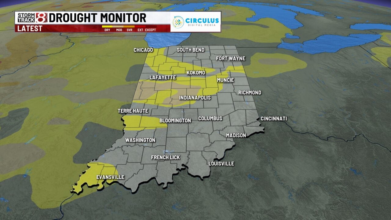
The new drought monitor update for today, August 10, is the best we have looked in several weeks. On top of that, much of the state is above normal in regards to August 2023 rain.

However, it needs to be mentioned that the concern for flooding may continue to grow if we keep seeing larger weather systems every few days. Let’s take Wednesday, August 9, for instance in which we saw a train of heavy rain set up just north of interstate 70.
Some spots saw over three inches of rain in just a few hours, and flood advisories were issued because of this occurring.

That system and the ones we’ve had since late June eventually add up over time. You combine that with areas that have had prolonged saturated ground and additional heavy rain potential, there could be a considerable flash flood threat in the near future.
Speaking of flash flooding, there are risks for excessive rain Sunday and Monday.
How did we get here to begin with? Well, we’re currently positioned in an El-niño summer. This occurrence has historically yielded wet summers in the past. We did a story on this back in June, and you can check out more on that history and its setup here: El Niño is developing, what does that mean for this summer in central Indiana?