Hurricane Helene to bring unprecedented impact to the southeastern United States
INDIANAPOLIS (WISH) — Hurricane Helene is set to make landfall by Thursday night in the big bend region of Florida.
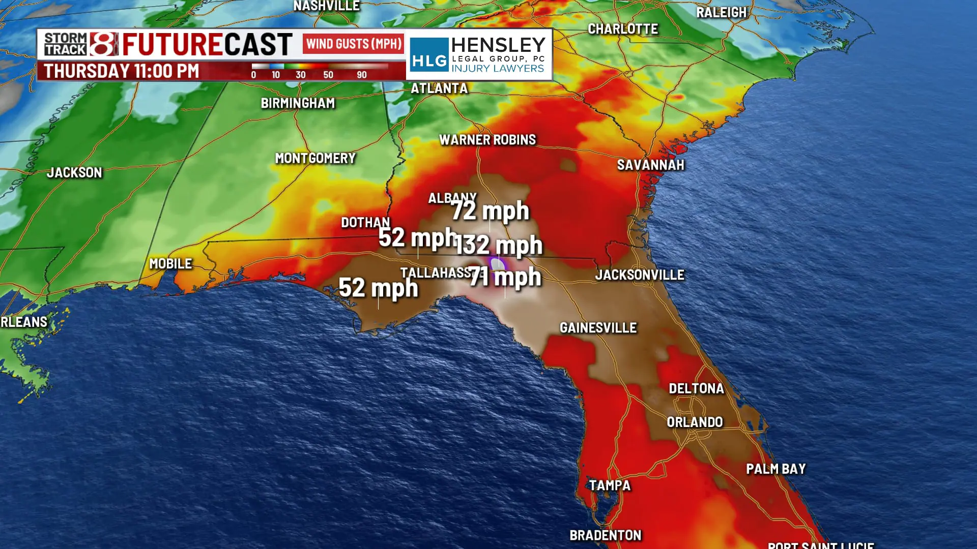
This large system is expected to bring widespread strong winds and heavy rain from the southeastern United States up through the Ohio valley region. Tornadoes will also be possible mainly on the eastern side of the storm. Several states have already declared a state of emergency in advance of the incoming behemoth.
The circumstances of Helene are going to be a bit unusual compared to past tropical systems due to how far inland the high winds get alone. Matter of fact, Helene is roughly 575 miles wide. This is the equivalent of the distance from Indianapolis to Norfolk, VA.

It is also worth noting that Helene is taking a track much similar to Idalia from late August 2023. However, Idalia will likely pale in comparison to Helene. On top of that, this will be the ninth major hurricane (Category 3+) to make landfall in the United States since 2017.

Let’s break down the areas to be affected:
FLORIDA: There is already tropical storm force wind gusts occurring through a good chunk of Florida due to the outer bands of Helene. The panhandle region is set to experience the worst of Helene with extreme winds and life-threatening storm surge of up to 15-20 (which is practically unsurvivable) feet in Apalachee Bay. There is great concern that even Tallahassee suffers damage that has not been seen with previous hurricanes.


A serious risk for flash flooding is also in place through part of the Florida panhandle as up to several inches of rain will add onto the misery of conditions into tonight.


GEORGIA: This is going to be one of the most historic tropical systems to track into Georgia, and that is not hyperbole. Widespread high winds with some gusts possibly over 100 MPH will hammer the state. Residents in Georgia should have already prepared for the likelihood of massive power outages and numerous tress being toppled.


There is also a high risk for excessive rainfall through almost half of Georgia.
SOUTHERN APPALACHIAN REGION: This will be one of the most significant weather events in the history of the western Carolinas and northeast Georgia region. Record flooding is being forecasted and comparisons are being made to past events such as the 1916 floods in Asheville, NC. Due to lofty rain amounts of over 10″ expected in this area, some landslides are likely to happen.


High winds will also cut through this region as well.
REMAINDER OF THE PATH: Helene is going to bring strong winds and heavy all the way up into states such as Tennessee, Kentucky, Indiana. Wind advisories cover a large chunk of the lower Ohio and Tennessee valleys. Wind gusts up to 50-55 MPH are ahead for those in these advisories. Some areas could be upgraded to high wind warnings as well.


It is also important to mention that there is an elevated tornado threat into tonight and Friday up along the east coast from southeastern Georgia to eastern North Carolina. It is not out of the question for strong tornadoes to form given the potent environment that will be in play.

