Hurricane Lee set to target eastern New England, the Canadian Maritimes
INDIANAPOLIS (WISH) — Hurricane Lee on Wednesday afternoon was in the process of making its northward turn which will take it close to New England.
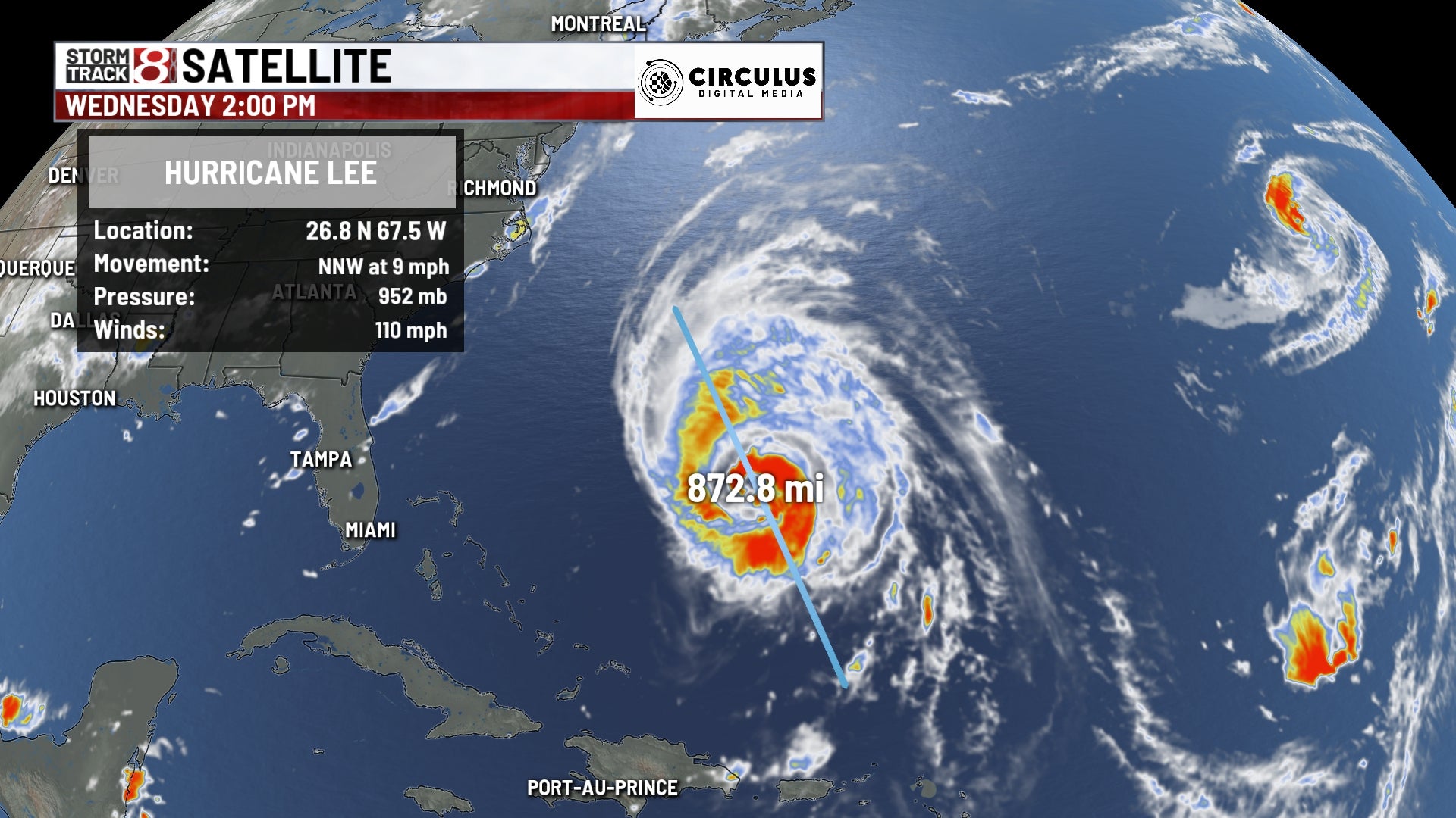
The storm was a Category 2 hurricane with maximum winds of 110 mph as of the 2 p.m. Wednesday advisory. On satellite, the storm was very large and stretching over 800 miles with its cloud tops.

The center of the storm will likely make landfall in Maine or the Canadian Maritimes. Although Hurricane Lee will weaken over cooler water, the storm will grow in size and expand its wind field.

The forecast on Wednesday afternoon from the National Hurricane Center has the storm becoming an extratropical storm shortly after landfall Saturday night or early Sunday. As the storm passes east of New England, Lee could still be hanging onto hurricane status.
Wind field of Hurricane Lee
Below is the Global Forecast System model run depicting Hurricane Lee over 150 miles away from Boston on Saturday morning. Despite it being that far away, gusts with tropical storm force easily will make it into eastern Massachusetts. If the center tracks closer, areas on the eastern portions of Cape Cod could get hurricane-force gusts.
Parts of Maine will likely see sustained winds with tropical storm force and potentially gusts with hurricane force near the landfall point.

Potential rainfall in eastern New England
Just like with the winds of Lee, the track will play a large role in rainfall numbers. If Lee makes landfall in Maine, a half foot of rainfall is not out of the question. Eastern Cape Cod will have the highest rain totals in Massachusetts. A lot of areas in southern New England have picked up flooding rains in prior days, so the ground is already saturated.

Be sure to stick with WISH-TV for the latest updates on Hurricane Lee as it tracks close to New England.