Tropical Storm Hone threatens Hawaii with fire and floods
(CNN) — The Atlantic hurricane season might be quiet for now, but the same can’t be said in the Pacific, where Tropical Storm Hone is threatening to deliver a weekend blow to Hawaii.
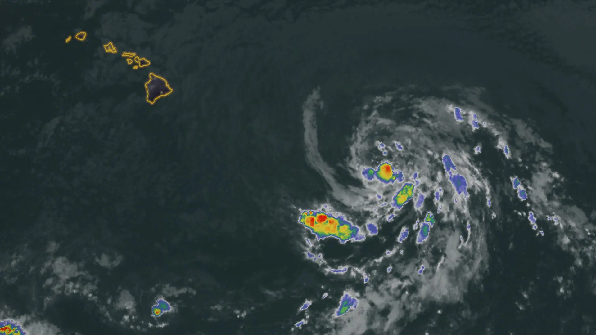
A tropical storm warning has been issued for Hawaii’s Big Island with the storm on track to pass close to the state this weekend. It will deliver heavy rain, strong winds, dangerous seas and fire concerns to a tinder-dry state still recovering from one of the most devastating fires in US history.
“Tropical storm conditions are expected in the warning area as early as Saturday afternoon and continuing into Sunday,” the National Hurricane Center said in its 8 p.m. HST advisory.
Tropical activity has been abundant in the Pacific Ocean this year, but none of the seven East Pacific named storms have come close to Hawaii. Hone, the first storm to form in the Central Pacific since 2019, will break that mold.
The storm is about 595 miles from Honolulu. It has maximum sustained winds of 50 mph, with tropical storm winds extending outward up to 115 miles from the center, the National Hurricane Center said.
The storm is forecast to pass about 150 miles south of the Big Island late Saturday into Sunday morning.
“Strengthening is forecast during the next 48 hours, and may become a hurricane by Sunday, followed by weakening late Sunday and beyond,” the center said.
Rain and wind will persist for much of the weekend after Hone’s outer rainbands begin to impact the Big Island in the earliest hours of Saturday morning.
Widespread rainfall totals of 5 to 10 inches are expected on the windward and southeast facing slopes of the Big Island, according to the National Hurricane Center. Maui could see around 6 inches and Oahu could pick up 2 to 4 inches of rain into early next week, especially on the eastern sides of the island. Heavy rain could cause flash flooding and area waterways to swell.
In addition to potentially flooding rainfall, Hone will also deliver gusty winds this weekend, especially over the Big Island.
“Winds are expected to be strongest where they blow downslope from higher terrain, over headlands and through passes,” the CPHC warned Friday.
The storm’s strongest winds will likely last from late Saturday through Sunday as it makes its closest pass south of the Big Island. Tropical storm-force wind gusts – up to 73 mph – are possible.
Breezy conditions will pick up late Friday night and early Saturday over the island chain ahead of Hone’s worst conditions. This will raise fire danger over parts of the state where winds get stronger without rain to accompany them.
“Drier air and windy conditions ahead of Hone could elevate fire weather concerns across leeward areas statewide (Saturday),” the National Weather Service in Honolulu cautioned Friday.
Leeward areas generally include the western and southern coasts of each island in Hawaii’s chain.
The increased fire danger is particularly concerning given drought conditions in the state are worse this year than they were at the time of last year’s devastating wildfires. Wildfires in Maui last August left more than 100 people dead and caused $6 billion in damage.
Given Hone’s rain, fire weather conditions don’t appear to be as severe as those during last year’s fires, but if dry fuels like grasses and trees catch fire, they‘ll quickly go up in flames. Strong winds could fan those flames and rapidly spread fire to nearby locations.
Around the time of last year’s fires, about 15% of the state was experiencing at least moderate drought, according to the US Drought Monitor. As of August 20, moderate drought or worse conditions covered 73% of Hawaii.
Hone will strengthen late Sunday into Monday and could become a hurricane briefly. At this point, the system will likely be centered 300 to 400 miles southwest of Hawaii’s islands.
After Hone moves away early next week, it may not be the only system Hawaii contends with over the next couple of weeks.
Gilma, which was a Category 3 hurricane as of Friday morning as it roared over the open Pacific, will track west over the weekend and through much of next week. The system will weaken as it approaches Hawaii, but whatever remains of it could take a swipe at the state late next week.
Interests in and around Hawaii may need to continue to monitor for tropical trouble even into early September.