As the hot weather comes to an end, strong storms look to swing in
INDIANAPOLIS (WISH) — The heat will end soon, but strong storms look to move in for the beginning of the work week.
SUNDAY NIGHT: A warm night is in store for us with mainly clear skies. The humid conditions will also stick around throughout the night. Lows will only fall into the low 70s.

MONDAY: Isolated storm chances will be possible for us in the mid-afternoon and through the evening hours. Afternoon threat for storms should be relatively spotty. A strong line of storms will work in from the northwest late Monday night. Some of these storms could be strong to severe.


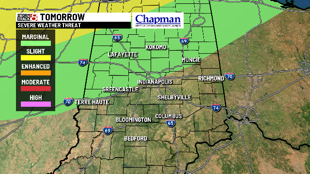
A marginal risk is in place for most of the northern half of the state. Isolated damaging winds and hail are the primary threats along with heavy rainfall.

Highs will top out in the upper 80s.

TUESDAY: We will have a better chance of storms, in which they will be widespread at times. We will see two rounds of storms, and the first round will be in the morning hours. Heavy rainfall will be possible with some of the storms.


The second round will arrive in the afternoon hours. This wave has the chance to produce stronger storms, and some of these could turn severe. A marginal risk is in place for all of central Indiana. Isolated damaging winds and hail will be the primary threats.

Highs will top out in the mid 80s.

8 DAY FORECAST: Lingering shower chances will continue through Wednesday before we have a brief break from the rain on Thursday. However, rain chances pick back up on Friday, and this will carry on throughout next weekend. Temperatures look to slide into the mid 80s for the rest of the week after Monday.

